On this page
Long before container ships and freight trains, salt, silk, spices and silver crossed the world on foot, on camels, mules and horses, and in wooden hulls. The ancient trade routes they followed decided which cities grew rich, which religions spread and, surprisingly often, where today's highways run. Many of those lines are still there: an Italian highway that keeps its Roman name, a German cycle path that follows the salt carts, a Sikkim mountain road sold as the "Old Silk Route".
This guide maps 21 of the great trade routes of the world, from the Silk Road and the Incense Route to the Hanseatic sea lanes and the galleons that crossed the Pacific. For each one we cover what moved, when and who carried it, then what the route looks like now. Where you can drive or ride part of it, we link a TrailX route so you can open the map, check the elevation profile and start planning.
We traced ten of those routes specially for this guide, following modern roads through the old caravan towns. Treat them as a way in, not a reconstruction: the caravans didn't use tarmac, and in most places nobody knows exactly where their tracks ran.
How to read the map
- Solid lines are overland routes, including the four that mix land with sea or river legs: the Spice Route, the Incense Route, the Volga route and the route from the Varangians to the Greeks.
- Dashed lines are sea lanes: the Maritime Silk Road, the Hanseatic routes and the Manila galleon.
- Tap any line for its era, goods, length (where sources agree on one), how it looks today, UNESCO status and links to TrailX routes along it.
- Paths are approximate. We drew each line through its key places in order, at roughly 10–30 km precision. Desert crossings and the eastern Persian Royal Road are reconstructions, so read every line as an illustration, not a surveyed alignment.
The ancient trade routes at a glance
| Route | Era | Goods | Today | TrailX routes |
|---|---|---|---|---|
| Silk Road | 2nd c. BCE – mid-15th c. | Silk, horses, paper, glassware | Two UNESCO corridors; highways and freight rail | 2 |
| Tea Horse Road | Tang/Song – mid-20th c. | Brick tea, Tibetan ponies, salt | Highways; stone paths survive | 1 |
| Grand Trunk Road | 3rd c. BCE onwards | Textiles, spices, horses, salt | Working highway in four countries | 1 |
| Leh–Yarkand | Centuries old – 1949 | Silk, tea, pashmina, cotton goods | Karakoram Pass closed; Nubra road trip | 3 |
| Lhasa–Kalimpong | Peak 19th–20th c. – 1962 | Wool, silk, medicines, fuel | Nathu La limited trade; Zuluk road | 1 |
| Incense Route | Peak c. 3rd c. BCE – 2nd c. CE | Frankincense, myrrh, spices | Four UNESCO sites; Yemen off-limits | 1 |
| King's Highway | Iron Age – 16th c. | Frankincense, spices, pilgrims | Jordan's Highway 35 | 1 |
| Via Maris | Early Bronze Age – 16th c. | Grain, copper, textiles | Israeli highways; Biblical Tels | 2 |
| Persian Royal Road | 5th c. BCE – Roman times | Royal post, tribute | No single successor; Gordion, Susa | 1 |
| Trans-Saharan | Peak 8th – early 17th c. | Gold, salt, enslaved people | Azalai caravans; Moroccan gateways | 1 |
| Amber Road | From 16th c. BCE | Amber, furs, Roman glass | EuroVelo 9; Poland's "Amber Highway" | 2 |
| Via Salaria | Pre-Roman – Roman | Salt | SS4 state highway | 1 |
| Old Salt Route | 956 – 16th c. | Lüneburg salt | 95 km cycle route | 1 |
| Volga route | Late 8th – 11th c. | Furs, honey, silver dirhams | Reservoirs; Volga–Baltic Waterway | 1 |
| Varangians to the Greeks | c. 800 – 11th c. | Furs, wax, wine, silk | Rapids drowned; split by borders | 1 |
| Hanseatic sea routes | Late 12th c. – 1669 | Herring, stockfish, salt, cloth | UNESCO old towns; Baltic ferries | 0 |
| Qhapaq Ñan | 15th – early 16th c. | State goods, messages | UNESCO 2014; walkable sections | 1 |
| Camino Real de Tierra Adentro | 1598 – 1882 | Silver, supplies | UNESCO; I-25 and Highway 45 | 1 |
| Maritime Silk Road | 2nd c. BCE – 15th c. | Ceramics, silk, spices | Busy shipping lanes; Quanzhou | 0 |
| Spice Route | Antiquity – 16th c. | Cloves, nutmeg, pepper | Container lanes; Suez Canal | 0 |
| Manila galleon | 1565 – 1815 | Silk, porcelain, silver | Major ports; UNESCO bid in preparation | 0 |
Across Asia
The Silk Road
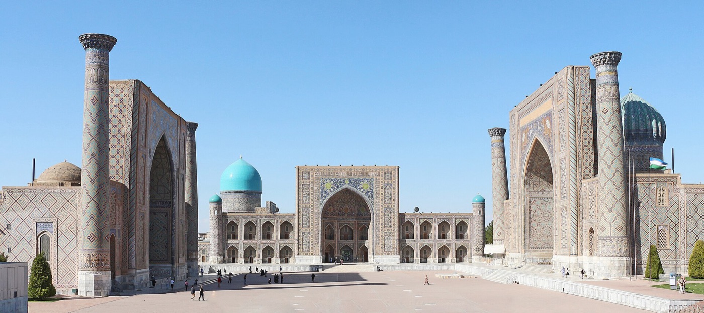 The Registan in Samarkand, Uzbekistan. Photo: Bernard Gagnon / Wikimedia Commons, CC0
- Era: c. 2nd century BCE – mid-15th century CE
- Carried: silk, horses, spices, paper, porcelain, glassware
- Runs through today: China, Kyrgyzstan, Tajikistan, Uzbekistan, Turkmenistan, Iran, Iraq, Syria, Türkiye
Then. The Silk Road was never one road. From the Han dynasty's opening of the west, a web of caravan routes ran more than 6,400 km overland from Chang'an (today's Xi'an) through the Hexi Corridor and the Tarim Basin oases to Kashgar, Samarkand, Bukhara, Merv, Persia and the Levant. Silk went west; horses, glass and silver came east, and so did Buddhism, Islam, Manichaeism and Nestorian Christianity. The name only dates from the late 19th century.
Now. Two UNESCO serial listings cover long stretches: the 5,000 km Chang'an–Tianshan Corridor (2014) and the 886 km Zarafshan–Karakum Corridor (2023). Samarkand, Bukhara and the Mogao Caves are World Heritage Sites too. Afrosiyob trains link Tashkent, Samarkand and Bukhara, and highways and China–Europe freight rail follow the Hexi Corridor. Browse more China scenic drives, or plan your own stretch with our multi-stop road trip planner.
Follow it on TrailX: Silk Road: Samarkand to Bukhara Drive (279.1 km, on-road) · Hexi Corridor: Jiayuguan to Dunhuang Drive (379.5 km, on-road)
The Ancient Tea Horse Road
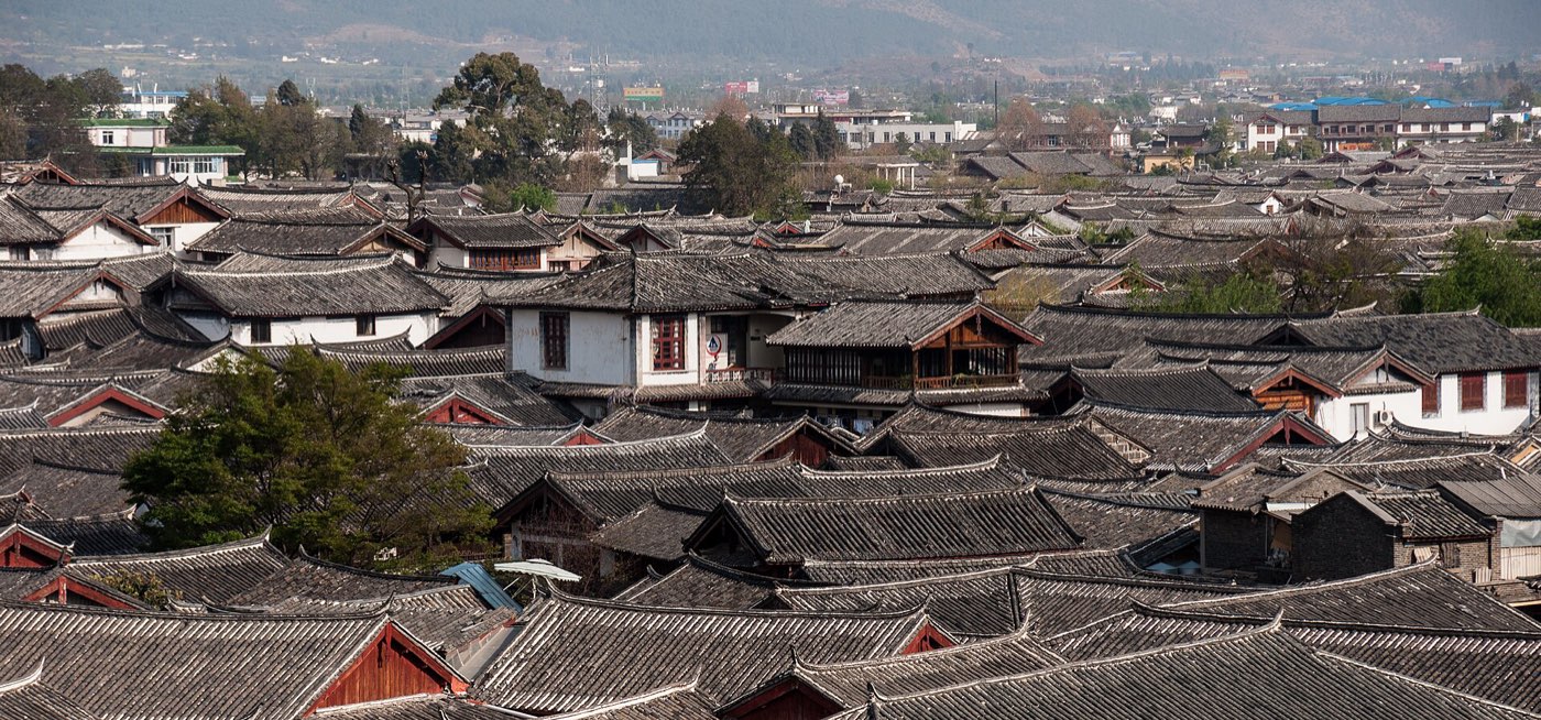 Tiled roofs of Lijiang's old town, Yunnan, China. Photo: CEphoto, Uwe Aranas / Wikimedia Commons, CC BY-SA 3.0
- Era: Tang/Song dynasties – mid-20th century
- Carried: pressed brick tea, Tibetan ponies, salt, Sichuan silk
- Runs through today: China
Then. Mule paths crossed the Hengduan Mountains from the tea districts of Yunnan and Sichuan to Lhasa, and on to Nepal, Bhutan and India. The road is named for its central swap, Chinese brick tea for the Tibetan horses China's armies needed, a trade dating at least to the Song dynasty. One branch ran via Dali, Lijiang and Shangri-La; another left Ya'an for Kangding, where porters carried 60–90 kg loads. Published lengths run from 3,000 km to over 10,000 km.
Now. Highways, and the Sichuan–Tibet railway under construction, follow its valleys, but stone-paved stretches survive and some can be hiked. China listed parts of the road as a national key cultural relic in 2013. Shaxi's Sideng market, the most complete surviving caravan market town, and Lijiang's old town draw visitors. Our drive passes both and climbs 8,895 m, so read the elevation profile first. Carrying on towards Nepal? Start with your first trek in Nepal.
Follow it on TrailX: Tea Horse Road: Dali to Shangri-La Drive (403.3 km, on-road)
The Grand Trunk Road
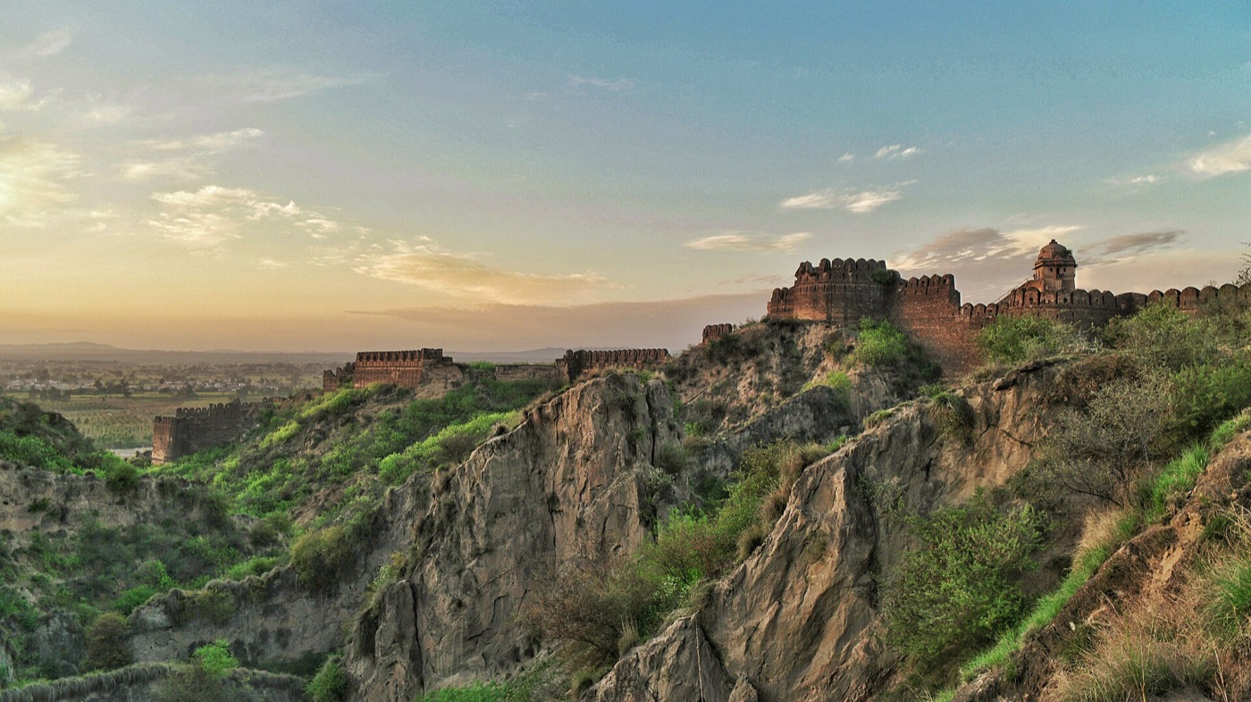 Rohtas Fort, Sher Shah Suri's stronghold near Jhelum, Pakistan. Photo: Hussain Khalid / Wikimedia Commons, CC BY-SA 4.0
- Era: Mauryan road 3rd century BCE; realigned 16th century; rebuilt 1833–1860
- Carried: textiles, spices, horses, salt, grain, post
- Runs through today: Bangladesh, India, Pakistan, Afghanistan
Then. One of Asia's oldest and longest roads runs roughly 3,655 km from Teknaf and Chittagong to Kabul, and has linked South and Central Asia for at least 2,500 years. It began as the Uttarapatha, the "Northern Road" of Buddhist texts; Chandragupta Maurya had officials maintain it, and Ashoka planted trees and dug wells along it. Sher Shah Suri realigned it with caravanserais, kos minars (milestones) and stepwells, and the British rebuilt it.
Now. It's still a working highway: N1 and N4 in Bangladesh, NH 19, NH 44 and NH 3 in India, the N-5 in Pakistan and the Torkham–Jalalabad–Kabul road. Mughal-era kos minars and serais stand beside it in Haryana and Punjab, Rohtas Fort is a World Heritage Site, and India put the sites along it on UNESCO's Tentative List in 2015. Find more road trips among our India scenic drives.
Follow it on TrailX: Dwarka - Prayagraj Sangam (661.7 km, on-road)
The Leh–Yarkand caravan route
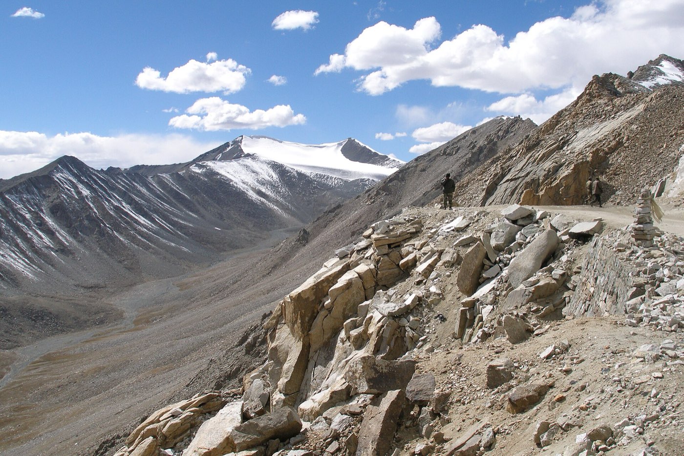 The road up to Khardung La in the Ladakh Range. Photo: Vyacheslav Argenberg / Wikimedia Commons, CC BY 4.0
- Era: centuries old – closed 1949
- Carried: silk, tea, precious stones, pashmina, cotton goods, leather, spices
- Runs through today: India (Ladakh), China
Then. This high caravan route linked Leh in Ladakh with Yarkand in the Tarim Basin. The summer route crossed Khardung La into the Nubra valley, then the glaciated Saser La, the 5,300 m Depsang Plains and the 5,540 m Karakoram Pass, its highest point, before Suget and the grazing grounds at Shahidulla. Silk, tea, precious stones and pashmina came south; cotton goods, leather, spices and opium went north, on about 10,000 horses a year at the mid-19th-century peak.
Now. The trade ended when China sealed the border in 1949, and the Karakoram Pass has no road and is closed in a disputed, militarised zone. The Ladakh end is a popular road trip over Khardung La into Nubra, with an Inner Line Permit; beyond Nubra the country is restricted. In China, the G219 passes the old halt at Xaidulla. Our Himalayan passes of India guide covers these passes, and crossing high passes covers the altitude.
Follow it on TrailX: Leh to Leh - Nubra Circuit (534.3 km, on-road) · Diskit to Siachen - Nubra Route (114.2 km, off-road) · Diskit to Saser La Expedition (117.1 km, off-road) · more in Ladakh off-road routes
The Lhasa–Kalimpong trade route
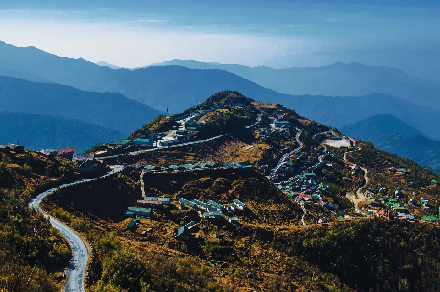 Zuluk, on East Sikkim's "Old Silk Route" road. Photo: Linus pradhan / Wikimedia Commons, CC BY-SA 4.0
- Era: British-era peak 19th–20th century; closed 1962
- Carried: Tibetan wool, silk, salt, medicines, fuel, manufactured goods
- Runs through today: China, India
Then. Mule caravans left Lhasa via Gyantse, Phari and the Chumbi Valley and crossed the Himalaya at Jelep La (4,390 m) for Kalimpong or Nathu La (4,310 m) for Gangtok, passes only about 4–5 km apart. It became British India's main trade route with Tibet: J. W. Edgar reported trade over Nathu La in 1873, and Younghusband used both passes in 1903–04. In the 1950s most China–India trade still came this way; northbound loads even included disassembled cars.
Now. The passes were sealed after the 1962 war. Nathu La reopened in 2006 for limited trade, seven to eight months a year, and for Kailash pilgrims; Jelep La is still closed. The Zuluk road is marketed as the "Old Silk Route", more tourism label than history. Our drive follows the old Kalimpong–Pedong–Zuluk mule route, climbing 3,107 m; you need a protected-area permit beyond Rongli, and foreigners are normally restricted. Both passes are in our Himalayan passes of India guide.
Follow it on TrailX: Old Silk Route: Kalimpong to Zuluk Drive (89.0 km, on-road)
Arabia and the Levant
The Incense Route
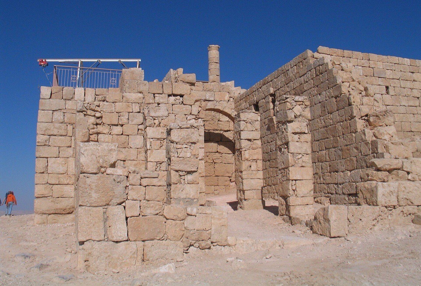 Nabataean ruins at Avdat in Israel's Negev. Photo: Bukvoed / Wikimedia Commons, CC BY 4.0
- Era: c. 3rd century BCE – 2nd century CE (peak)
- Carried: frankincense, myrrh, Indian spices, precious stones, pearls, textiles
- Runs through today: Oman, Yemen, Saudi Arabia, Jordan, Israel, Palestine
Then. Frankincense from Dhofar in Oman was shipped from Khor Rori (Moscha Limen) to Qana, then carried by camel via Shabwa, Najran, Mecca, Medina and Hegra to Petra, and across the Negev to Gaza. UNESCO describes a network of "over two thousand kilometers"; Pliny put Thomna to Gaza at 1,487 Roman miles in 65 camel stages. Tolls made the South Arabian kingdoms and the Nabataeans rich, until Roman ships learned to sail straight to India on the monsoon.
Now. Four UNESCO listings trace it: Oman's Land of Frankincense (2000), Hegra in Saudi Arabia (2008, the country's first, with 111 monumental tombs), Petra (1985) and the Negev towns of Avdat, Haluza, Mamshit and Shivta (2005). Hegra has recently opened to tourism, but the Yemeni sections can't be visited safely. Our drive links the Negev towns; Haluza lies off minor roads, so the route may stop short. New to desert driving? Read our first overlanding trip checklist.
Follow it on TrailX: Incense Route: Negev Desert Cities Drive (187.1 km, on-road)
The King's Highway
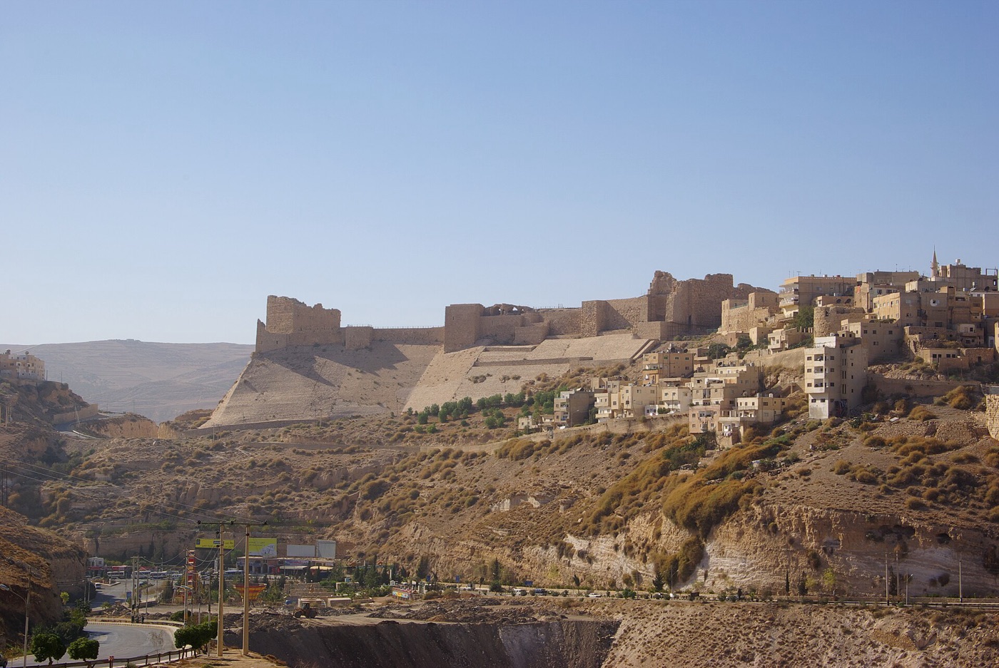 Kerak Castle above the town of Kerak, Jordan. Photo: Berthold Werner / Wikimedia Commons, CC BY 3.0
- Era: Iron Age (and earlier) – 16th century CE
- Carried: frankincense, spices, luxury goods, Hajj pilgrims
- Runs through today: Egypt, Jordan, Syria
Then. Tradition runs it from Egypt across Sinai to Aqaba, then north through Petra, Kerak, Madaba, Amman, Bosra and Damascus towards the Euphrates, though scholars dispute exactly what the name covered. It appears in the Book of Numbers; the Nabataeans carried incense along it, and Trajan rebuilt it as the Via Traiana Nova. From the 7th century it was the main Hajj road from Syria to Mecca, until the Ottomans built a new road in the 16th century.
Now. Jordan's Highway 35, with Highway 15 and the Aqaba Highway, follows it from Irbid to Aqaba. The southern stretch, through the Wadi Mujib canyon and past Kerak and Shobak castles, is a winding, scenic drive, with Petra and Madaba's mosaic map on the way. The Syrian sections, Bosra and Palmyra included, are hard to reach. Our drive covers Madaba to Petra with 3,931 m of climbing; plan your overnight stops in the Route Composer.
Follow it on TrailX: King's Highway: Madaba to Petra Drive (232.2 km, on-road)
The Via Maris
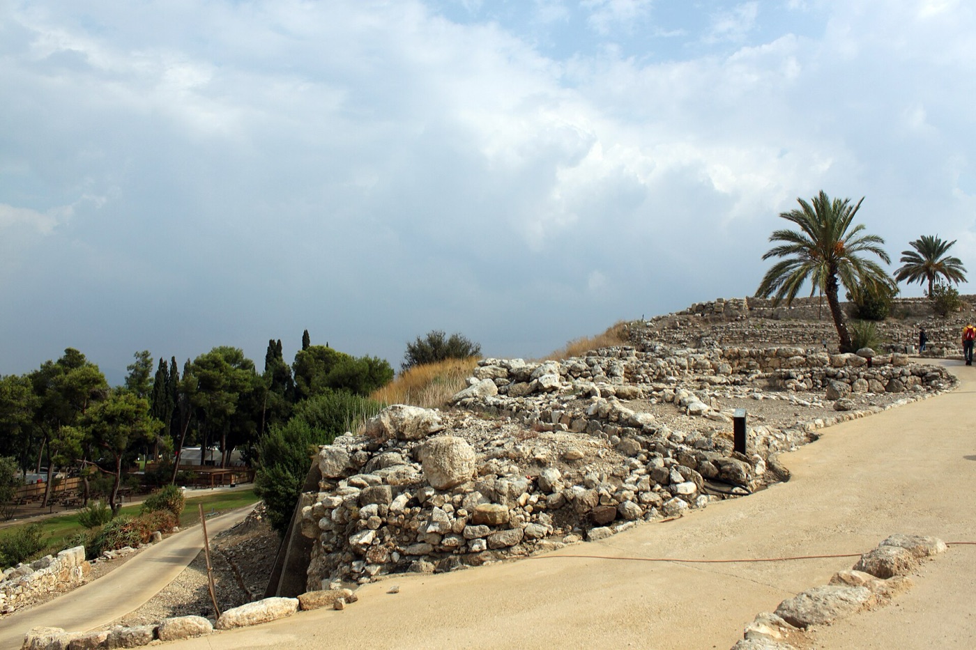 Excavations at Tel Megiddo, Israel. Photo: Anagoria / Wikimedia Commons, CC BY 3.0
- Era: early Bronze Age – 16th century CE
- Carried: grain, copper, textiles, luxury goods, armies and messengers
- Runs through today: Egypt, Palestine, Israel, Syria
Then. With the King's Highway, this was one of the ancient Levant's two great north–south routes. It left Egypt at Pelusium and followed the coast through Gaza, Ashkelon and Aphek, turned inland at Megiddo through the Jezreel Valley to the Sea of Galilee, passed Capernaum and Hazor, crossed the Jordan at Jacob's Ford and climbed the Golan to Damascus. The name is a later Latin rendering of Isaiah's "way of the sea", and scholars disagree about which road it first meant.
Now. Israel's coastal highways and the roads through the Jezreel Valley and past the Sea of Galilee follow its line. Megiddo and Hazor are UNESCO-listed among the Biblical Tels (2005), and Capernaum and Tel Aphek are excavated sites. The Sinai, Gaza and Golan sections are closed or affected by conflict, so check current security advice even for Galilee, and read our safety guidelines. For more riding, browse our Israel cycling routes.
Follow it on TrailX: Eshbal Galilee Ride (26.5 km, cycling) · Ness Ziona to Tel Aviv Ride (27.0 km, cycling)
The Persian Royal Road
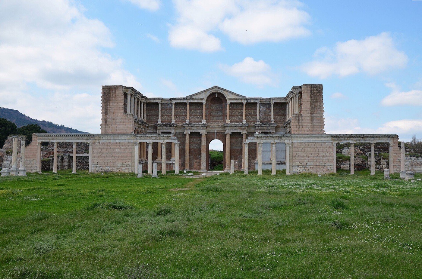 The Roman bath-gymnasium at Sardis, Türkiye. Photo: Carole Raddato / Wikimedia Commons, CC BY-SA 2.0
- Era: reorganised 5th century BCE; in use through Roman times
- Carried: royal post and dispatches, tribute, luxury goods, troops
- Runs through today: Türkiye, Iraq, Iran
Then. The Achaemenids reorganised this highway in the 5th century BCE, probably under Darius I, to link Susa with Sardis in western Anatolia: 1,677 miles, about 2,699 km. It had 111 posting stations, and relay couriers were supposed to cover it in nine days, against ninety on foot; Herodotus wrote that "nothing in the world travels faster than these Persian couriers". Its western sections may be older Assyrian roads, and its course east of the Halys river is debated.
Now. There's no single modern successor, though highways across central Anatolia and northern Iraq roughly follow its line. Sardis is an active excavation. Gordion, where a 6.25 m Roman gravelled roadbed has been found nearby, became a World Heritage Site in 2023, and Susa has been one since 2015. Our drive links Sardis with Gordion; to add your own stops, see how to plan a multi-stop road trip.
Follow it on TrailX: Royal Road: Sardis to Gordion Drive (418.9 km, on-road)
Africa
The Trans-Saharan gold and salt road
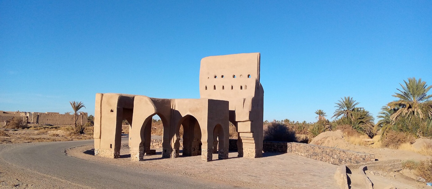 The ruined north gate of Sijilmasa near Rissani, Morocco. Photo: Hmidanix / Wikimedia Commons, CC BY-SA 4.0
- Era: peak 8th – early 17th century CE
- Carried: gold, salt, enslaved people, kola nuts, cowrie shells, textiles
- Runs through today: Morocco, Algeria, Mali
Then. The region's earliest evidence of domesticated camels dates from the 3rd century CE; regular routes developed with the Islamisation of West Africa in the 7th–8th centuries. Ibn Battuta reported caravans averaging about 1,000 camels, some as large as 12,000. Rock salt from Taghaza, where he said the buildings were made of salt, was exchanged for West African gold, enriching the Ghana, Mali and Songhai empires. Portuguese coastal trade from 1445 and the Battle of Tondibi in 1591 undercut it.
Now. Sijilmasa is a ruin field near Rissani, and Taghaza was abandoned by the late 16th century for Taoudenni. Azalai salt caravans still run from Timbuktu to Taoudenni and from Agadez to Bilma, but insecurity keeps most travellers out of northern Mali, and Timbuktu has been on the List in Danger since 2012. Visitors see the Moroccan gateways instead: Zagora, M'Hamid and Merzouga. Before you leave the tarmac, read our off-road terrain analysis guide.
Follow it on TrailX: Drâa Valley Caravan Road: Ouarzazate to M'Hamid (251.9 km, on-road), down the palm-lined Drâa valley to where the road ends and the sand begins
A trade route is really a chain of places that lived off people passing through: wells, markets, toll stations, inns. Many of them outlasted the trade, and they're the best reason to slow down.
Europe
The Amber Road
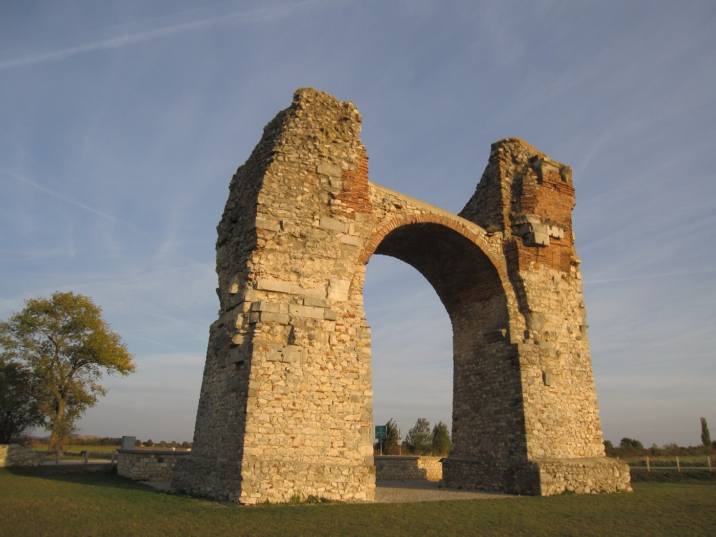 The Roman Heidentor at Carnuntum, Austria. Photo: Gryffindor / Wikimedia Commons, CC BY-SA 3.0
- Era: from at least the 16th century BCE; main Roman route 1st–2nd centuries CE
- Carried: amber, furs, animal skins, honey, wax, Roman glass
- Runs through today: Russia (Kaliningrad), Poland, Czechia, Austria, Hungary, Slovenia, Italy
Then. Baltic amber, the "gold of the north", moved south to the Mediterranean from at least the 16th century BCE; Baltic amber beads appear in Tutankhamun's breast ornament. The Roman-era road ran from the Baltic coast across Poland (via Kalisz, probably Ptolemy's "Calisia"), through Moravia, over the Danube at Carnuntum and past Ptuj, Celje and Ljubljana to Aquileia on the Adriatic.
Now. The EuroVelo 9 "Amber Route" cycle route follows it from Gdańsk to Pula, and Poland's A1 motorway is nicknamed the "Amber Highway". Carnuntum is an archaeological park, Aquileia is a World Heritage Site, and Gdańsk and Yantarny in Kaliningrad still trade in amber. Two existing TrailX rides sit close to the line, one in northern Poland and one in Hungary; for more, browse our Poland cycling routes.
Follow it on TrailX: Braniewo Countryside Ride (207.6 km, cycling) · Vas County Road Ride (101.4 km, cycling)
The Via Salaria
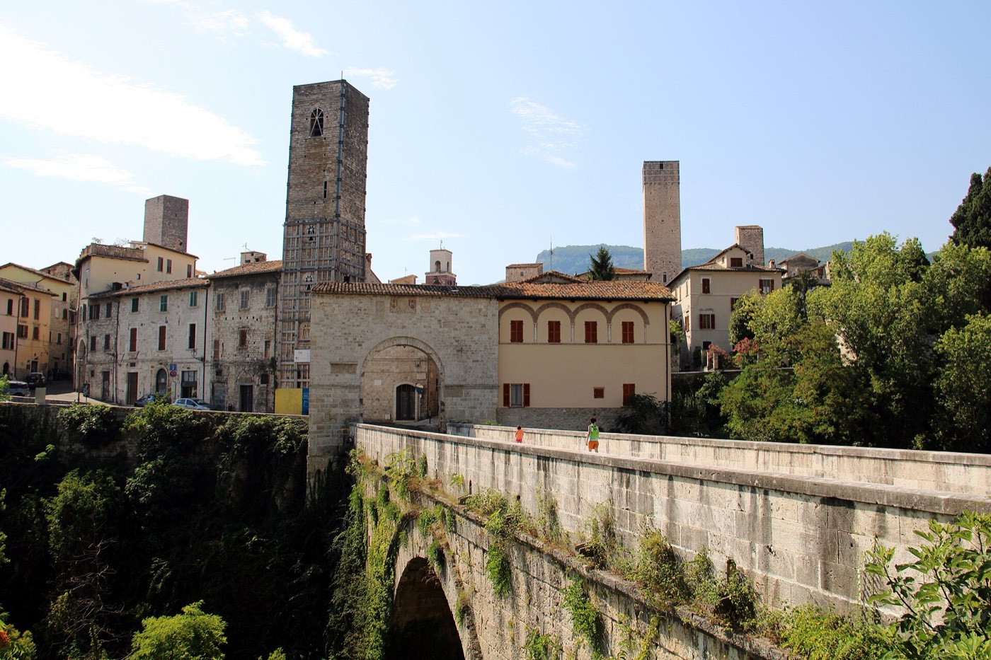 The Roman bridge of Solestà in Ascoli Piceno, the Roman Asculum. Photo: Mongolo1984 / Wikimedia Commons, CC BY-SA 4.0
- Era: pre-Roman salt track; later a Roman consular road
- Carried: salt
- Runs through today: Italy (Lazio)
Then. Rome's "salt road" began as the track the Sabines used to fetch salt from the marshes at the mouth of the Tiber. As a Roman road it ran 242 km from the Porta Salaria through Reate (Rieti) and Asculum (Ascoli Piceno) to Castrum Truentinum on the Adriatic. Some historians see the salt trade on this route as the origin of Rome itself.
Now. Strada Statale 4 keeps the name and runs on the same line. Roman bridges survive along it, including the Ponte Salario in Rome and the Ponte di Quintodecimo near Acquasanta Terme, and the mountain stretch crosses the area hit by the 2016 earthquakes around Accumoli and Arquata del Tronto. Our drive follows the SS4 to San Benedetto del Tronto. Near Rome, try our Lazio cycling routes; further north, our Alpine pass road trips.
Follow it on TrailX: Via Salaria: Rome to the Adriatic Drive (220.8 km, on-road)
The Old Salt Route
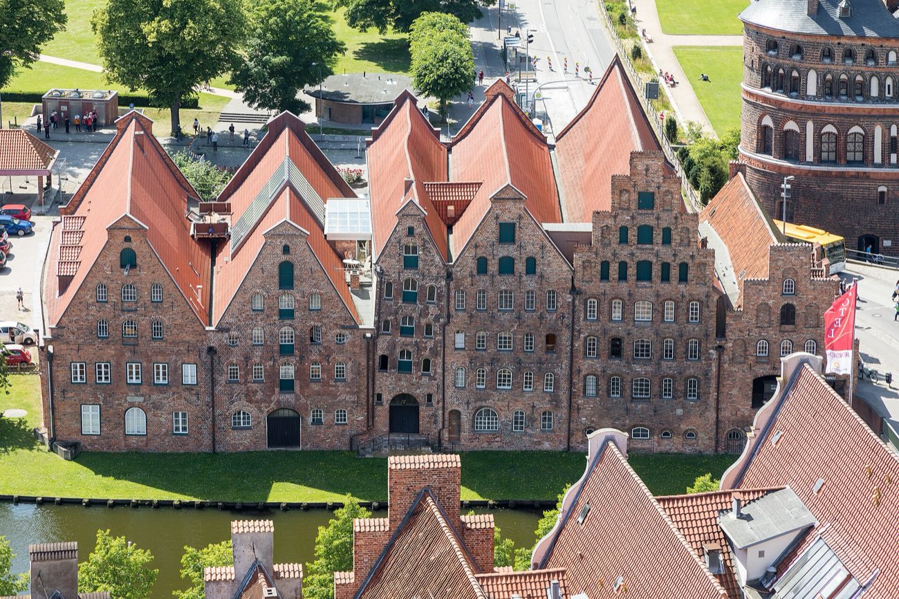 The historic salt storehouses (Salzspeicher) on the Trave in Lübeck. Photo: JoachimKohler-HB / Wikimedia Commons, CC BY-SA 4.0
- Era: documented from 956 CE; peak 12th–16th century
- Carried: Lüneburg brine salt, and onward the herring it preserved
- Runs through today: Germany (Lower Saxony)
Then. Lüneburg's brine salt, "white gold", went north by cart to Lübeck, crossing the Elbe at Artlenburg and passing Mölln. From Lübeck it crossed the Baltic to the Scania Market to preserve herring, a major source of Hanseatic power. From 1398 the Stecknitz Canal, one of Europe's first artificial waterways, took much of the traffic; in the 16th century about 19,000 tonnes a year made the roughly 20-day trip.
Now. A signposted route links Lüneburg, Lauenburg, Mölln and Lübeck: 95 km main, 106 km scenic through the Lauenburg Lakes Nature Park. Historic paving survives near Breitenfelde, and Lübeck's old town is a World Heritage Site. It's the one route here you can easily ride end to end: our ride is 91.4 km with just 234 m of climbing. New to multi-day riding? Start with gravel riding for beginners, then find more cycling in Germany.
Follow it on TrailX: Old Salt Route Ride: Lüneburg to Lübeck (91.4 km, cycling)
The Volga trade route
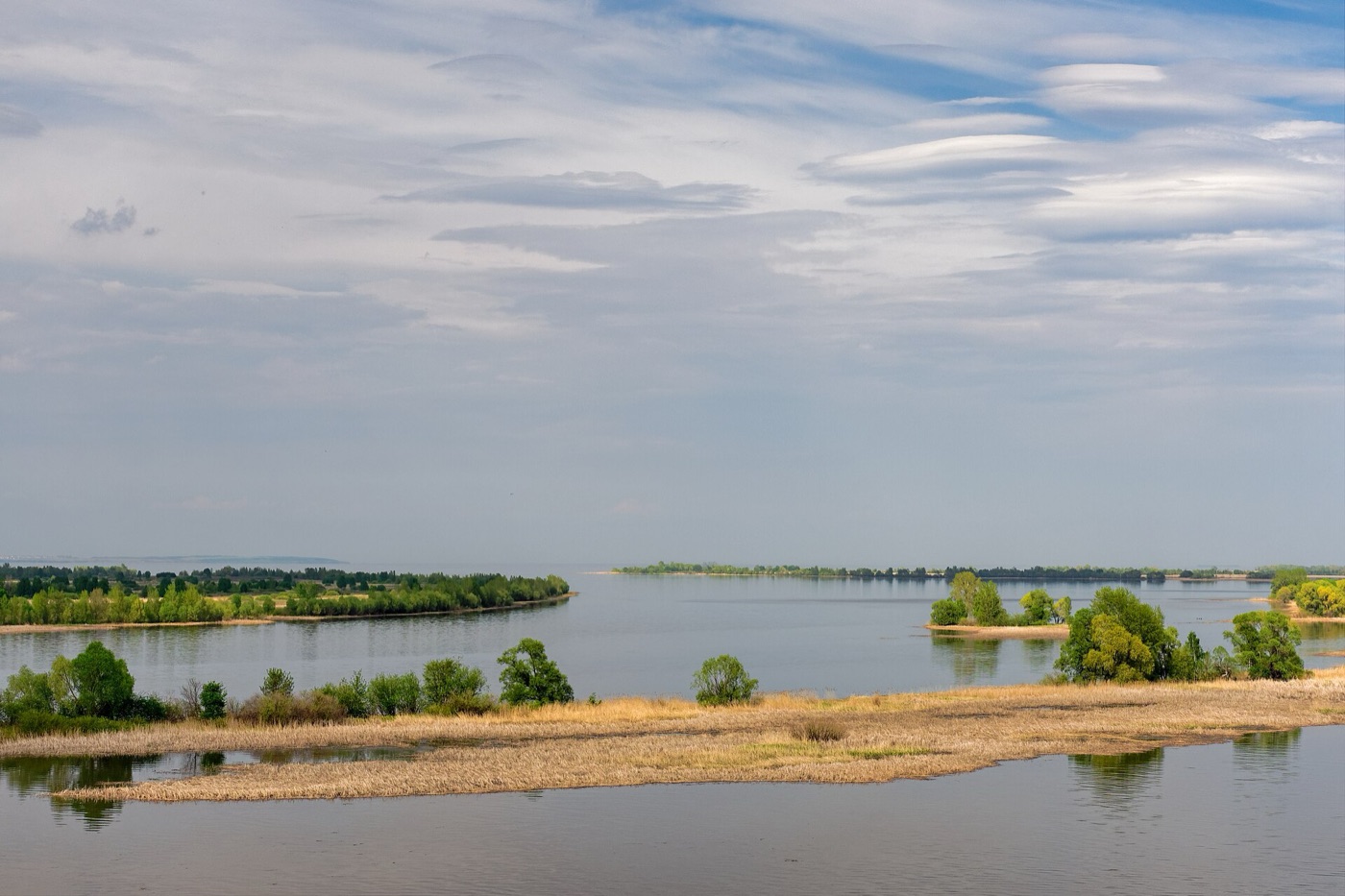 The Volga at Bolgar, Russia. Photo: Alexxx1979 / Wikimedia Commons, CC BY-SA 4.0
- Era: late 8th – 11th century CE
- Carried: furs, honey, swords, enslaved people, Arab silver dirhams
- Runs through today: Sweden, Russia, Kazakhstan, Azerbaijan, Iran
Then. The Rus, Scandinavian traders who settled at Staraya Ladoga in the early 9th century, carried furs, honey and enslaved people up the Volkhov to Novgorod, by portage to the upper Volga and downriver to the Volga Bulgars, the Khazars and the Caspian, sometimes reaching Baghdad. They were paid in Arab silver dirhams, whose hoards still turn up across Scandinavia and Russia. Ibn Fadlan met the Rus at Bolgar in 921–922. The route faded in the 11th century.
Now. The Volga is still Russia's main inland waterway, now a chain of reservoirs, and the Volga–Baltic Waterway replaces the portages. Bolgar became a World Heritage Site in 2014, and Novgorod (1992), Staraya Ladoga and Birka in Sweden mark the northern end. Sources name more than one portage, so the line on our map is a best guess.
Follow it on TrailX: Redkino Volga Ride (60.5 km, cycling)
The route from the Varangians to the Greeks
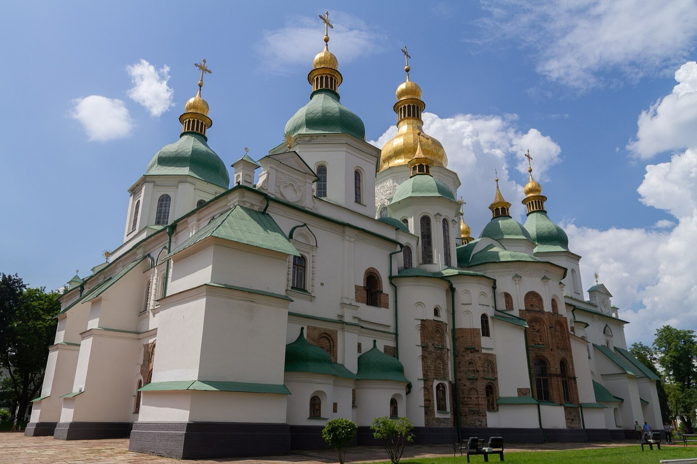 Saint Sophia Cathedral in Kyiv. Photo: Maksym Kozlenko / Wikimedia Commons, CC BY-SA 4.0
- Era: late 8th/early 9th – 11th century CE
- Carried: furs, honey, wax, amber, timber; wine, silk, glass, icons
- Runs through today: Sweden, Russia, Belarus, Ukraine, Romania, Bulgaria, Türkiye
Then. This medieval waterway ran from the Baltic up the Neva, Lake Ladoga and the Volkhov to Novgorod, then by Lake Ilmen, the Lovat and portages to the Dnieper near Smolensk, and down past Kyiv, where fleets gathered each June. Boats were dragged around seven Dnieper rapids, a 50 m drop over 66 km, rigged with sails at Berezan Island and coasted to Constantinople. Furs, wax and amber went south for wine, silk, glass and icons. It helped forge Kievan Rus'.
Now. The rapids have been underwater since the DniproHES dam was built in 1932. Novgorod, Kyiv's St Sophia and Istanbul are World Heritage Sites, Gnezdovo's burial mounds survive near Smolensk, and Viking runes can be seen in Romania's Murfatlar caves. The route now crosses Russia, Belarus and Ukraine, so it can't be followed end to end; our ride stays in Kyiv.
Follow it on TrailX: Kyiv Left Bank Ride (87.6 km, cycling)
The Hanseatic sea routes
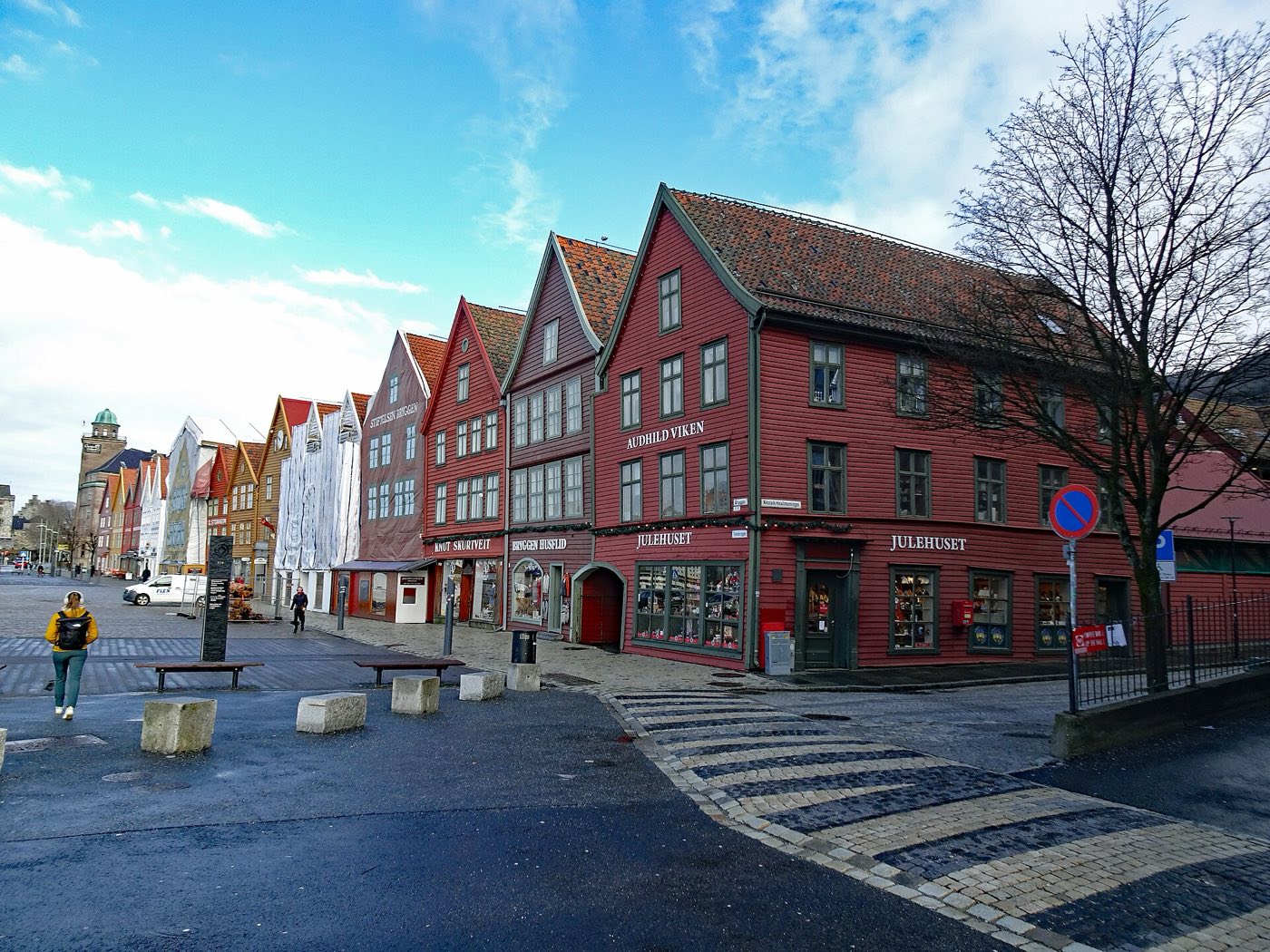 Bryggen, the Hanseatic Kontor in Bergen, Norway. Photo: Spudgun67 / Wikimedia Commons, CC0
- Era: late 12th century – 1669
- Carried: salted herring, stockfish, salt, grain, timber, furs, Flemish and English cloth
- Runs through today: United Kingdom, Belgium, Netherlands, Norway, Denmark, Sweden, Germany, Poland, Estonia, Latvia, Russia
Then. Growing out of Lübeck after its refounding in 1159, the Hanseatic League became a network of nearly 200 merchant towns that dominated North Sea and Baltic trade from the 13th to the 15th centuries. Its cogs carried wax, furs, timber, grain and fish west and returned with cloth. Its four Kontors were the Steelyard in London, Bruges, Bryggen in Bergen and the Peterhof in Novgorod, and Lübeck and Hamburg's control of Lüneburg salt underpinned the herring trade.
Now. Lübeck, Visby, Bryggen, Stralsund and Wismar, Tallinn and Riga are World Heritage Sites, a "New Hansa" association of former member towns still meets, and ferries and container lines link the same ports. It's a sea lane, so there's nothing to drive, but Bergen's surroundings are on our Vestland page.
Follow it on TrailX: no route on the water, but the Old Salt Route Ride: Lüneburg to Lübeck (91.4 km, cycling) ends in Lübeck, the "Queen of the Hansa"
The Americas
The Inca road system (Qhapaq Ñan)
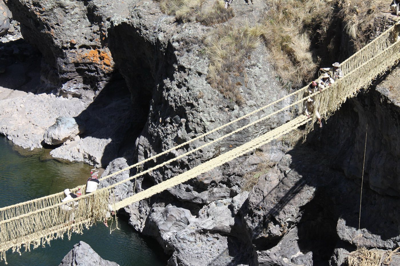 Q'eswachaka, the Inca rope bridge rebuilt every year, in the Cusco region of Peru. Photo: Ricardo Chirinos Portocarrero / Wikimedia Commons, CC0
- Era: 15th – early 16th century CE
- Carried: state goods on llama caravans, textiles, food stores, messages by chasqui runners
- Runs through today: Colombia, Ecuador, Peru, Bolivia, Chile, Argentina
Then. Radiating from Cusco, partly on older Wari and Tiwanaku roads, this network ran from southern Colombia to central Chile and Mendoza: about 40,000 km in all (estimates run from 23,000 to 60,000 km), with a main highland trunk of about 5,658 km. Without wheels, it moved soldiers, porters, llama caravans and chasqui relay runners between tambos a day's walk apart. The scholar Hyslop found its use largely reserved for state business: a state logistics network first, a merchant road second.
Now. UNESCO inscribed the Qhapaq Ñan in 2014 as a six-country site. Most of it was abandoned after the Spanish conquest, but stone sections, tambos and bridges survive, including Q'eswachaka. The Classic Inca Trail to Machu Picchu is permit-controlled, while other stretches, such as the Inca road to Ingapirca in Ecuador, can be walked. Browse our Peru hiking trails, or plan your own walk with the hiking route planner.
Follow it on TrailX: Cuenca Andes Off-Road Ride (49.5 km, off-road)
El Camino Real de Tierra Adentro
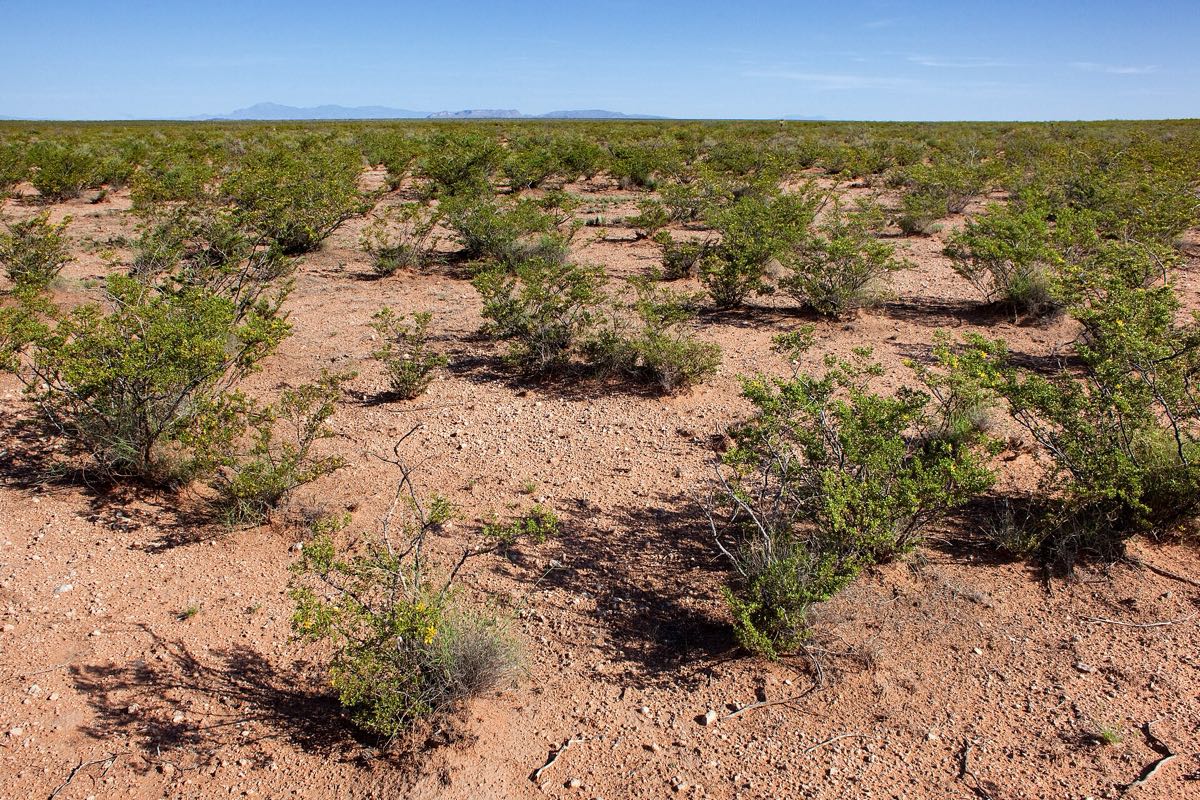 Scrub on the Jornada del Muerto plain, New Mexico. Photo: Patrick Alexander / Wikimedia Commons, CC0
- Era: 1598 – 1882
- Carried: silver, mission and presidio supplies, cattle, wool, textiles, hides
- Runs through today: Mexico, United States
Then. The Silver Route ran 2,560 km from Mexico City through Zacatecas, Durango and Chihuahua to El Paso del Norte and up the Rio Grande to Santa Fe and Ohkay Owingeh. Juan de Oñate's 1598 expedition opened the northern end, and the road was used until 1882. Silver went south; supply caravans went north with European goods and Asian goods from the Manila galleon. Its most feared stretch was the Jornada del Muerto, almost 100 km without water.
Now. UNESCO inscribed 55 sites along the 1,400 km Mexican section in 2010, and the 404-mile US section has been a National Historic Trail since 2000. Interstate 25 and Mexican Federal Highway 45 follow much of the line. For more, see our US scenic drives and Mexico cycling routes.
Follow it on TrailX: Turquoise Trail and Albuquerque Loop (213.3 km, on-road)
The great sea lanes
The Maritime Silk Road
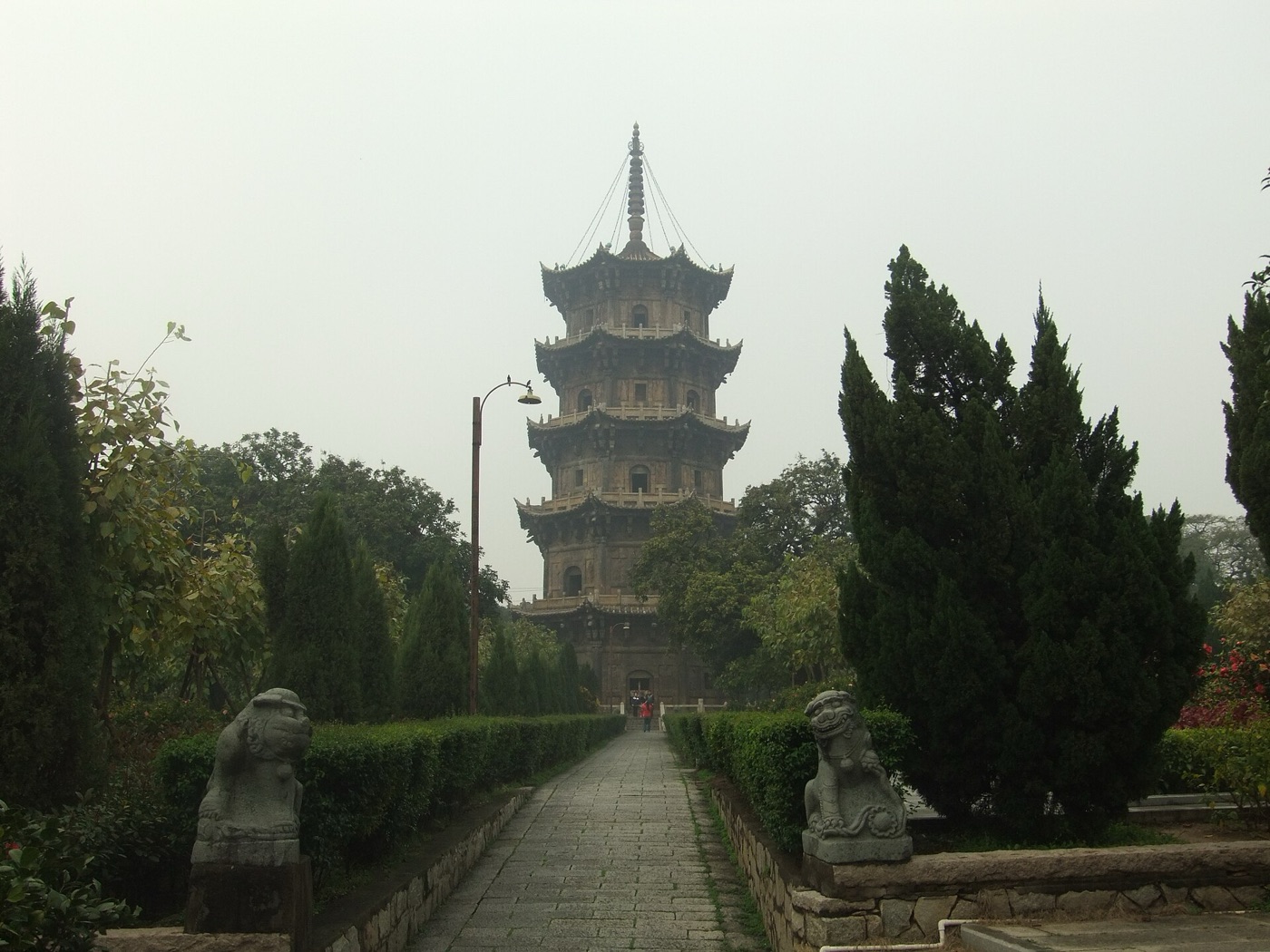 Renshou Pagoda at Kaiyuan Temple, Quanzhou, China. Photo: Vmenkov / Wikimedia Commons, CC BY-SA 3.0
- Era: by the 2nd century BCE – 15th century CE
- Carried: ceramics, silk, aromatics, camphor, spices, glass
- Runs through today: China, Vietnam, Malaysia, Singapore, Indonesia, Sri Lanka, India, Oman, Iran, Iraq
Then. Sea lanes across the Indian Ocean and western Pacific linked southern China and Southeast Asia with India, the Persian Gulf, Arabia and East Africa. Austronesian sailors pioneered them, followed by Persian and Arab dhows, Tamil merchants and, from the 10th century, Chinese junks. Srivijaya, founded at Palembang in 682 CE, grew rich controlling the Malacca and Sunda straits. Chinese ceramics are its most durable archaeological trace.
Now. The same chokepoints, Malacca, Sri Lanka and Hormuz, still carry a huge share of world shipping, and China has reused the name for the sea arm of its Belt and Road Initiative. Quanzhou, the port Arab traders called Zayton, became a World Heritage Site in 2021.
Follow it on TrailX: no route on the water, but you can explore ports it touched through our routes in Sri Lanka and Malaysia
The Spice Route
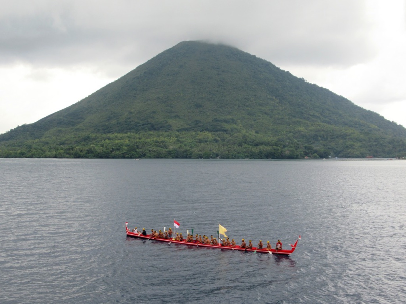 Gunung Api volcano in the Banda Islands, Indonesia. Photo: David Stanley / Wikimedia Commons, CC BY 2.0
- Era: antiquity – 16th century CE
- Carried: cloves, nutmeg, mace, black pepper, cinnamon, cassia
- Runs through today: Indonesia, Malaysia, Singapore, Sri Lanka, India (Kerala), Yemen, Egypt, Greece, Italy
Then. Cloves came from the Maluku Islands, nutmeg and mace from the Banda Islands and pepper from India's Malabar coast. They moved by sea via Malacca, Calicut and Aden and up the Red Sea; in antiquity they were landed at Berenice, carried across the desert to Coptos on the Nile and shipped on to Alexandria. Venice's monopoly at the European end pushed Portugal round Africa: Dias rounded the Cape of Good Hope in 1488, and da Gama reached Calicut in 1498.
Now. Container ships still run the Malacca – Indian Ocean – Red Sea line, using the Suez Canal where camels once crossed the Eastern Desert. Kerala is still a pepper and cardamom centre, the Banda Islands still grow nutmeg, and Venice's spice money survives in its buildings.
Follow it on TrailX: no road runs end to end, but Kerala has its own scenic drives
The Manila–Acapulco galleons
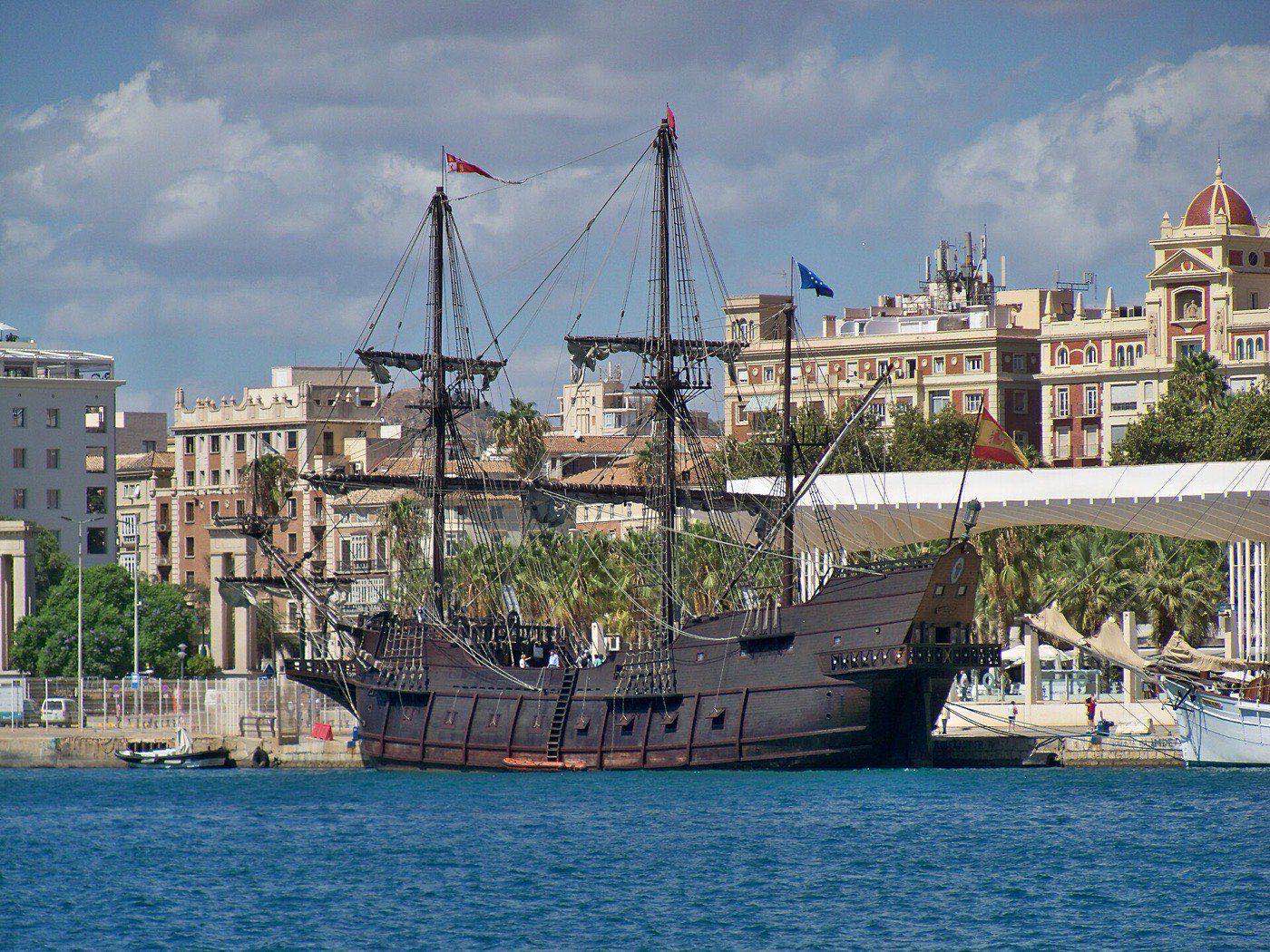 Galeón Andalucía, a modern replica of a Spanish galleon, in the port of Málaga. Photo: Daniel Capilla / Wikimedia Commons, CC BY-SA 4.0
- Era: 1565 – 1815
- Carried: Chinese silk, porcelain, spices, lacquerware, Mexican and Peruvian silver
- Runs through today: Philippines, Guam (US), Mexico
Then. Spanish galleons made one or two round trips a year between Manila and Acapulco, trading Chinese silk, porcelain and other Asian luxuries for silver from Mexico and Peru: the first sustained trans-Pacific trade route. Eastbound ships followed the tornaviaje found by Andrés de Urdaneta and Alonso de Arellano in 1565, riding the Kuroshio Current far north before making landfall between Point Conception and Cabo San Lucas. Westbound ships returned on the trade winds, calling at Guam.
Now. Acapulco and Manila Bay are still major ports, and the 1769 Portolá expedition founded San Diego and Monterey partly as safe harbours for the returning galleons. The Philippines and Mexico began preparing a UNESCO nomination in 2015, and container ships now cross the Pacific on similar tracks.
Follow it on TrailX: no route on the water, but the coast where the galleons made landfall is easy to explore: start with our California scenic drives
Planning a trip along an old trade route
Most of these routes are too long, and cross too many borders, to follow in one go. The best bits are usually short.
- Pick a stretch, not a route. Samarkand to Bukhara, Madaba to Petra and Lüneburg to Lübeck all make clear, manageable trips, and old caravan towns make natural overnight stops.
- Check borders and permits first. Several routes cross closed, disputed or unsafe ground: the Karakoram Pass, Jelep La, northern Mali, Yemen, Sinai, Gaza and the Golan. Others need permits, like Ladakh's Inner Line Permit or Sikkim's protected-area permit. Rules change often, so read current government travel advice and confirm permits shortly before you go.
- Plan it stop by stop. In the Route Composer, click the old trading towns onto the map, pick a hiking, cycling, on-road or off-road profile, and check the elevation profile, weather and points of interest before exporting a GPX. Our multi-stop road trip planner guide walks through it, and downloading GPX files explains the export. Got a historic route as KML or another format? Our GPX converter turns it into a GPX you can import.
- Respect the climbing. Mountain stretches look gentle on a flat map. The Tea Horse Road drive climbs 8,895 m; give yourself time.
- Go offline. Download the trail and regional maps in the TrailX app before you leave town, so you can keep navigating when the signal drops.
- Prepare for heat, cold and altitude. The caravans feared waterless stretches like the Jornada del Muerto for good reason, so carry more water and fuel than you think you need. Our first overlanding trip checklist, safety guidelines and gear checklist cover the rest.
- Treat sites gently. Many places here are excavations or World Heritage Sites: stay on paths and follow site rules.
Sources
Mainly English Wikipedia and UNESCO; anything disputed is flagged in the text.
- Silk Road and UNESCO's Chang'an–Tianshan Corridor
- Sea routes: Maritime Silk Road, Spice trade, Hanseatic League, Manila galleon
- Incense trade route, UNESCO's Desert Cities in the Negev and Pliny, Natural History 12
- Tea Horse Road and Grand Trunk Road
- Traces of silk: journey to the Karakoram Pass (Himalayan Journal 54) and Nathu La
- King's Highway, Via Maris and Royal Road
- Trans-Saharan trade and UNESCO's Timbuktu
- Amber Road, Via Salaria and Old Salt Route
- Volga trade route and Route from the Varangians to the Greeks
- Inca road system and UNESCO's Qhapaq Ñan
- UNESCO's Camino Real de Tierra Adentro and the US National Historic Trail
Map paths are hand-traced through each route's key places and are approximate.
Where to next?

Written by
TrailX
Hikers, riders and drivers mapping the world's trails, and sharing what we learn along the way.
Responses