The Trails of Rama: Tracing the Legendary Journey from Ayodhya to Lanka
Trace the legendary journey of Rama from Ayodhya to Lanka through Chitrakoot, Chhattisgarh's Dandakaranya, Kishkindha, Rameswaram and Rama Setu.
On this page
- 01An epic you can put on a map
- 02The journey at a glance
- 031. Ayodhya: the kingdom on the Saryu
- 042. Chitrakoot: the forest of exile
- 053. Dakshin Kosala and Dandakaranya: Chhattisgarh
- 064. Panchavati: the hermitage on the Godavari
- 075. Kishkindha: the kingdom of boulders
- 086. Rameswaram and Rama Setu: where India ends
- 097. Lanka: the island's own Ramayana
- 10Plan the journey
- 11Follow the story
The road runs out at Arichal Munai. For the last few kilometres it has been a thin grey line between two seas, the Bay of Bengal on one side and the Gulf of Mannar on the other, the wind pushing sand across the tarmac. Then there's a roundabout, a pillar, a crowd of pilgrims and tourists with their phones out, and nothing ahead but water the colour of turquoise and steel.
Somewhere out there, under the waves, a line of sandbanks and shoals runs east towards Sri Lanka. People here will tell you what it is: the bridge Rama's army built to reach Lanka and bring Sita home. Geologists will tell you something else. Both are, in their way, telling you the same thing: that this is the end of one of the great journeys in human storytelling.
That journey began nearly 2,000 km to the north, on the banks of the Saryu in Ayodhya. In between, it crosses the great forests of central India, river valleys, a kingdom of boulders and the sea. You can still follow it today, by road, rail and on foot.
An epic you can put on a map
The Ramayana is many stories. The oldest written version is Valmiki's Sanskrit epic, usually dated by scholars to somewhere between the middle of the first millennium BCE and the early centuries CE. It has been retold in almost every language of South and Southeast Asia since: Kamban's Tamil Ramavataram, Tulsidas's Ramcharitmanas in Awadhi, Thai, Khmer, Javanese and Malay versions, each with its own details.
The retelling goes on today. Amish Tripathi's Ram Chandra series of novels reimagines the epic for a new generation of readers, and in 2022 Amish took the journey off the page: in Legends of the Ramayana with Amish, a three-part docuseries for discovery+, he travelled some 5,000 km from Ayodhya to Sri Lanka in search of the places behind the stories. This guide follows the same idea, with one addition: the routes, so you can make the journey yourself.
The epic names its places, Ayodhya, Chitrakuta, Panchavati, Kishkindha, Lanka, but it doesn't come with coordinates. Over centuries, pilgrims, temples and local traditions have identified those names with real places across India and Sri Lanka. Some identifications are ancient and widely shared; others are disputed, and a few places are claimed by more than one town. Historians still argue about where the Lanka of the epic was meant to be.
So this guide works on two layers. The story follows the epic in order. The places are where tradition locates each episode today, and where you can actually go. The map below keeps them apart: pins mark traditional sites, solid lines are real TrailX routes you can follow, and the dashed line only shows the order of the story.
Joined in the order of the story, the sites cover about 3,500 km in straight lines, from the Gangetic plain through the Vindhya forests and the old Dandaka forest of Chhattisgarh, across the Deccan to the southern tip of India, then over the Palk Strait into the hills of central Sri Lanka.
The journey at a glance
| Stage | Place today | What tradition places here | TrailX route |
|---|---|---|---|
| 1. The kingdom | Ayodhya, Uttar Pradesh | Rama's birthplace and capital; the start of the exile | Ayodhya Heritage Walk: Ram Janmabhoomi to the Saryu Ghats |
| 2. The forest of exile | Chitrakoot, Uttar Pradesh–Madhya Pradesh | The first years of exile; Bharata's visit | Kamadgiri Parikrama, Chitrakoot, Chitrakoot Forest Road: Ramghat to Sati Anusuya Ashram |
| 3. The great forest | Dakshin Kosala and Dandakaranya, Chhattisgarh | Kaushalya's homeland; the long years of exile in the Dandaka forest | Dakshin Kosala Drive: Chandkhuri to Rajim and Sihawa, Bastar Waterfalls Drive: Chitrakote to Tirathgarh |
| 4. The hermitage | Panchavati, Nashik, Maharashtra | Surpanakha, the golden deer, and Sita taken by Ravana | Panchavati Walk: Ramkund to Tapovan, Nashik |
| 5. The vanara kingdom | Kishkindha: Hampi and Anegundi, Karnataka | Rama meets Hanuman; the alliance with Sugriva | Kishkindha Walk: Anjanadri Hill, Pampa Sarovar and Anegundi |
| 6. The sea | Rameswaram and Dhanushkodi, Tamil Nadu | Rama worships Shiva; the bridge to Lanka | Pamban to Arichal Munai - Dhanushkodi |
| 7. Lanka | Sri Lanka's hill country | Sita's captivity, Hanuman's search, Ravana | Sri Lanka Ramayana Trail Drive: Ramboda to Ella, Ravana Cave Walk from Ella |
1. Ayodhya: the kingdom on the Saryu
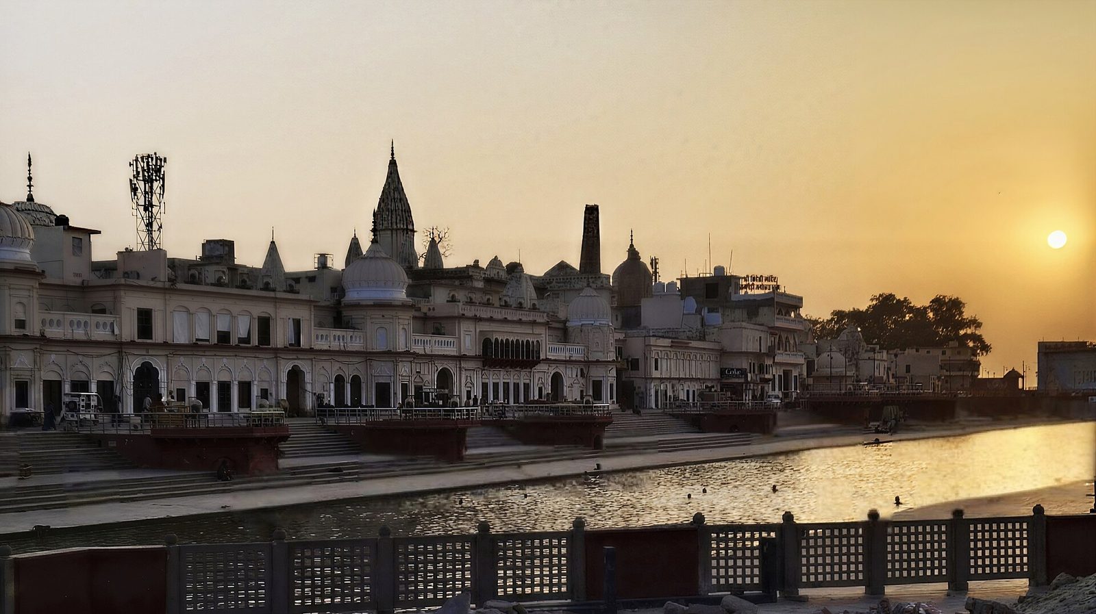 The ghats of Ram ki Paidi on the Saryu in Ayodhya at sunrise · Photo: Aliva Sahoo, CC BY-SA 3.0, via Wikimedia Commons
The story. Rama is the eldest son of King Dasharatha of Ayodhya, heir to the throne, newly married to Sita. On the eve of his coronation, a promise his father once made to his stepmother Kaikeyi is called in: Rama must go into exile in the forest for fourteen years. He leaves, with Sita and his brother Lakshmana, and the city follows his chariot to the river.
The place today. Ayodhya is a temple town on the south bank of the Saryu, one of the seven sacred cities of Hindu tradition. Its centre is the Ram Janmabhoomi temple, consecrated in January 2024, but the old town is a maze of hundreds of smaller temples and ashrams. The best way to feel it is on foot: from the temple, past Dashrath Mahal and up the steps of Hanuman Garhi, then down through the lanes to the river, where the ghats of Ram ki Paidi light up at dusk.
On TrailX: the Ayodhya Heritage Walk: Ram Janmabhoomi to the Saryu Ghats covers 4.8 km from the temple to Naya Ghat on the Saryu. New on TrailX.
Plan it: Ayodhya has an airport and good rail links. October to March is the comfortable season. Deepotsav at Diwali, when the ghats are lit with lakhs of lamps, is spectacular and very crowded.
2. Chitrakoot: the forest of exile
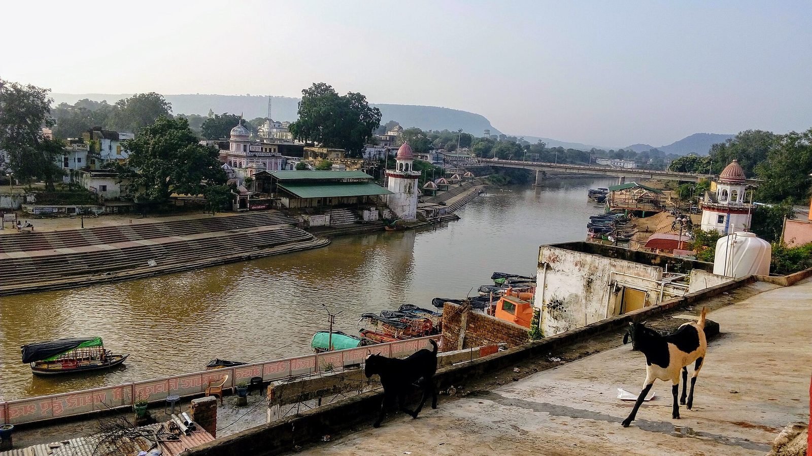 Ramghat on the Mandakini river at Chitrakoot, with temples along the bank · Photo: Engshubham, CC BY-SA 4.0, via Wikimedia Commons
The story. The exiles cross the Ganga and walk south into the forest, to the hill of Chitrakuta. Here they build a hut and live, and here Bharata, the brother who was meant to replace Rama on the throne, comes to beg him to return. Rama refuses, and Bharata goes home carrying his sandals, to place them on the throne until Rama comes back.
The place today. Chitrakoot sits on the Mandakini river, among the forested Vindhya hills on the border of Uttar Pradesh and Madhya Pradesh. Pilgrims walk a five-kilometre circuit around Kamadgiri, the hill revered as the heart of Chitrakoot, past the Bharat Milap temple, which marks the brothers' meeting. Upstream, a forest road follows the Mandakini to the ashram of Sati Anusuya, the sage's wife who, in the story, gives Sita gifts for her years in the forest.
On TrailX: the Kamadgiri Parikrama, Chitrakoot (4.6 km around the hill), and the Chitrakoot Forest Road: Ramghat to Sati Anusuya Ashram, 14.5 km by road up the river into the forest. The forest road is new on TrailX.
Plan it: the nearest railway station is Chitrakoot Dham (Karwi). The town is busiest on Amavasya (new moon) days and at Diwali.
3. Dakshin Kosala and Dandakaranya: Chhattisgarh
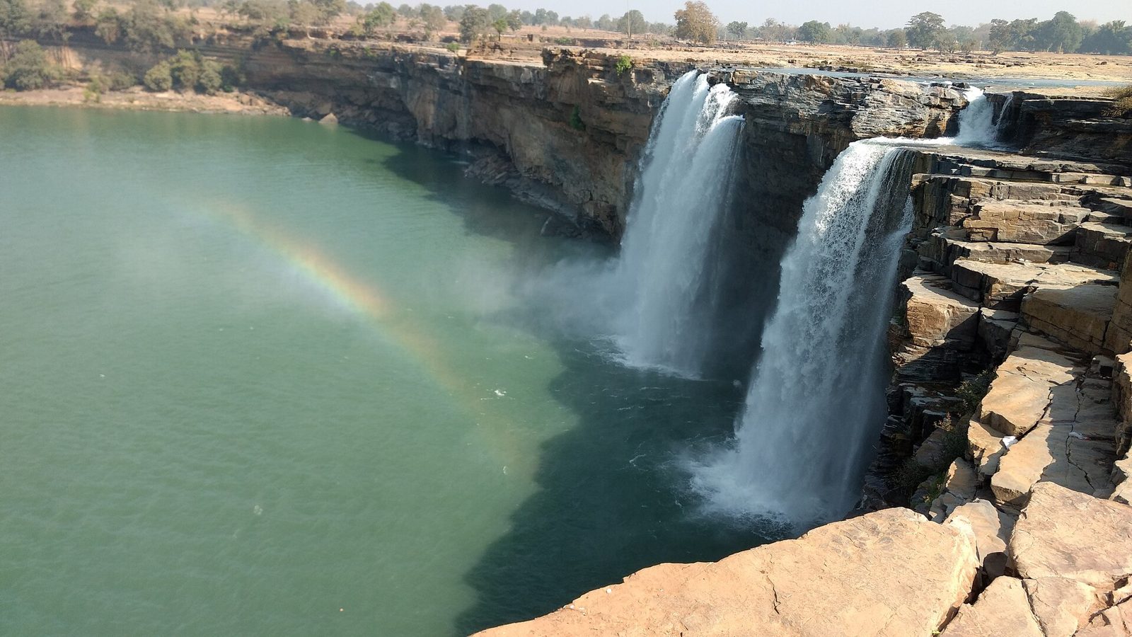 The Chitrakote Falls on the Indravati river in Bastar, in the forests tradition calls Dandakaranya · Photo: Ksh85, CC BY-SA 4.0, via Wikimedia Commons
The story. From Chitrakoot the exiles go deeper into the forest. For most of their fourteen years (ten, in Valmiki's telling) they wander the vast Dandaka forest, Dandakaranya, moving from one sage's hermitage to the next, before they settle at Panchavati.
The place today. Most retellings, and most travel guides, skip straight from Chitrakoot to Nashik. Chhattisgarh doesn't. The state identifies itself with Dakshin Kosala, "south Kosala", and tradition here holds that Rama's mother, Queen Kaushalya, was a princess of this land. That makes Rama the region's bhanja, its nephew, and in parts of Chhattisgarh people still bow to their sisters' sons out of respect for that tie. The state government's Ram Van Gaman Path identifies 75 places in Chhattisgarh where tradition says Rama passed, and 51 where he stayed. Nine have been developed in the first phase, from the north of the state to the far south:
- Sitamarhi-Harchauka (Koriya), caves on the Mawai river, where tradition says the exiles entered Dandakaranya.
- Ramgarh hills (Surguja), with the Sitabengra and Jogimara caves, rock-cut in the 3rd to 1st century BCE. Sitabengra is often called one of the oldest theatres in India, though some scholars think it was a travellers' rest house, and the hills are traditionally identified with the Ramagiri where Kalidasa's Meghaduta begins.
- Shivrinarayan (Janjgir-Champa), where tradition places Shabari, the devotee who tasted berries before offering them to Rama. Valmiki puts her hermitage near Lake Pampa, in the next stage of this journey; both places keep the story.
- Turturiya (Baloda Bazar), a forest hermitage linked with the sage Valmiki, where tradition says Sita gave birth to Lava and Kusha.
- Chandkhuri (Raipur), with the Mata Kaushalya temple on an island in the village lake, believed by many to be the only temple dedicated to Rama's mother.
- Rajim (Gariaband), at the confluence of the Mahanadi, Pairi and Sondur, with the Rajiv Lochan temple, dated by historians to between the 7th and 8th centuries.
- Sihawa (Dhamtari), in the forested hills where the Mahanadi rises, linked with the sage Shringi, who performed the ritual for King Dasharatha that led to the birth of Rama and his brothers.
- Jagdalpur (Bastar), the gateway to the waterfalls and caves of the Indravati valley, the deepest part of the old Dandaka forest.
- Ramaram (Sukma), in the far south, where tradition says Rama worshipped the earth goddess before going on.
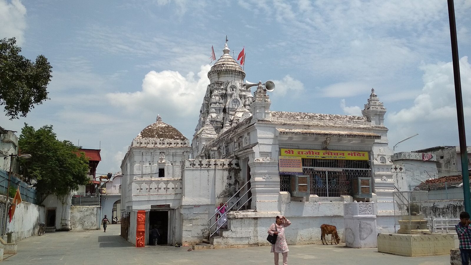 The Rajiv Lochan temple at Rajim, on the confluence of the Mahanadi · Photo: Abhi91m, CC BY-SA 4.0, via Wikimedia Commons
On TrailX: the Dakshin Kosala Drive: Chandkhuri to Rajim and Sihawa covers 171.9 km from the Kaushalya temple at Chandkhuri through Rajim and Dhamtari to the source of the Mahanadi at Sihawa. New on TrailX. Further south, the Bastar Waterfalls Drive: Chitrakote to Tirathgarh (70.0 km) drives through Bastar from the Chitrakote Falls on the Indravati to the falls at Tirathgarh. The paved trail up the Ramgarh hills to the caves isn't on OpenStreetMap yet; if you walk it, record it on TrailX.
Plan it: Raipur is the hub, with an airport and good rail links. October to February is the best season, and Chitrakote is at its most powerful after the monsoon. Parts of southern Bastar and Sukma are remote and have seen security problems; check local advice before travelling there.
4. Panchavati: the hermitage on the Godavari
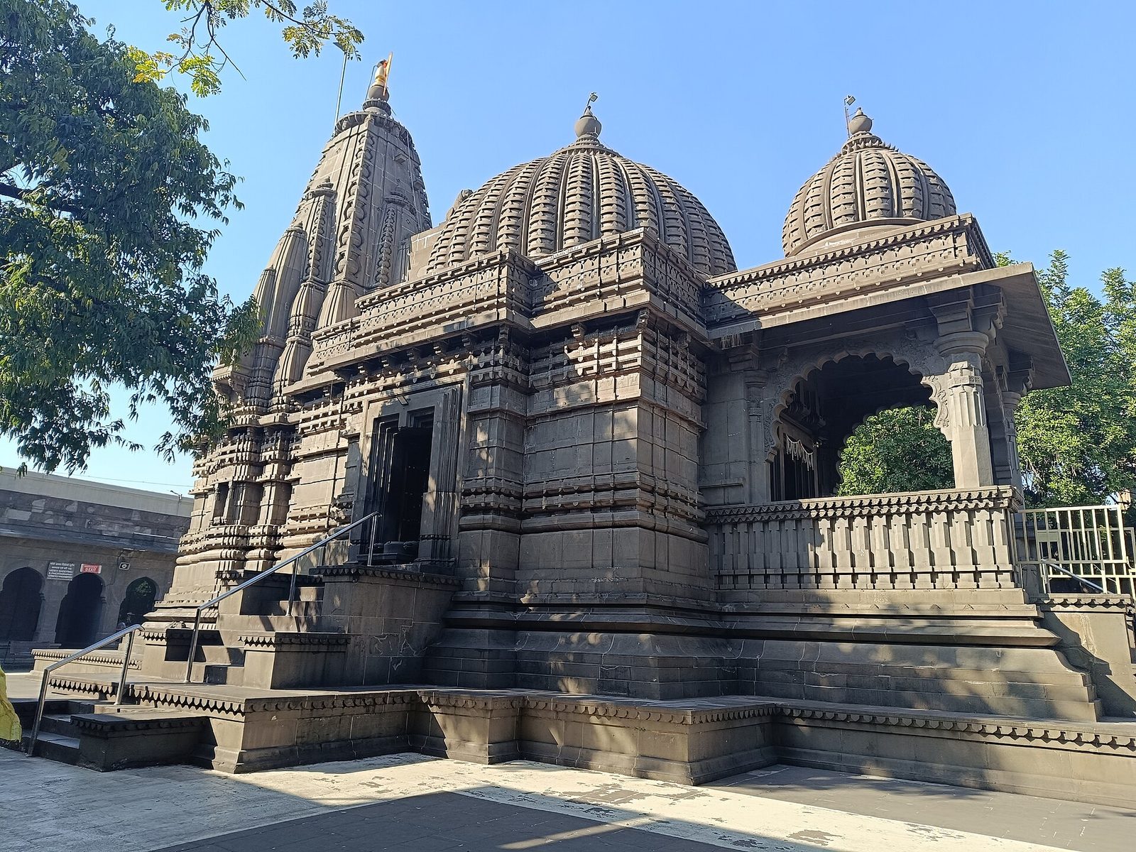 The black-stone Kalaram temple in Panchavati, Nashik · Photo: K.Venkataramana, CC0, via Wikimedia Commons
The story. After years in the forests of Dandaka, the exiles settle at Panchavati, "the five banyans", on the Godavari. This is where the story turns. Ravana's sister Surpanakha tries to seduce Rama and is mutilated by Lakshmana. Ravana sends the demon Maricha in the form of a golden deer to lure the brothers away, and carries Sita off to Lanka.
The place today. Panchavati is the old riverside quarter of Nashik, in Maharashtra. Pilgrims bathe at Ramkund, the ghat where Rama is said to have bathed, and visit the 18th-century Kalaram temple, built of black stone, and Sita Gufa, a narrow cave where tradition says Sita stayed. Downstream is Tapovan, where the Surpanakha episode is placed. Local tradition holds that the city takes its name from it: nasika means nose. Every twelve years, Nashik hosts the Simhastha Kumbh Mela on these same ghats.
On TrailX: the Panchavati Walk: Ramkund to Tapovan, Nashik covers 3.1 km from Ramkund past Kalaram and Sita Gufa to Tapovan. New on TrailX.
A side trip: Anjaneri, a hill near Trimbakeshwar about 20 km from Nashik, is one of several places that claim to be Hanuman's birthplace. That's a rivalry you'll meet again at the next stop.
5. Kishkindha: the kingdom of boulders
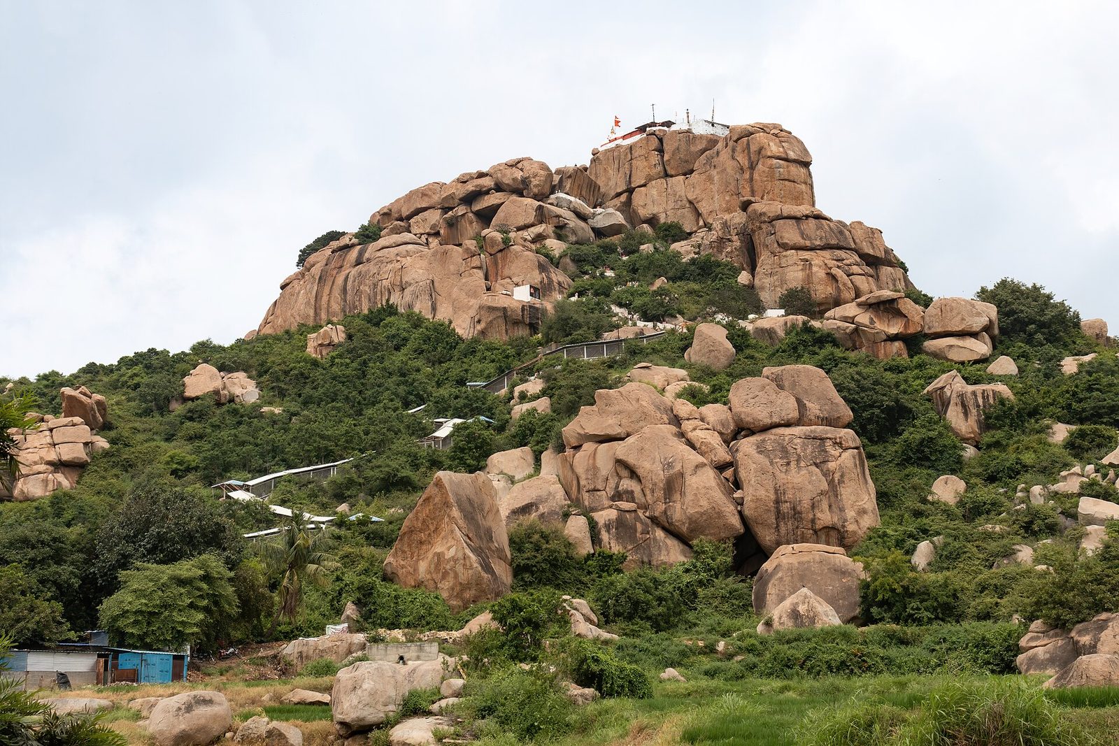 Anjanadri Hill near Hampi, with the white steps climbing through the boulders to the temple on top · Photo: iMahesh, CC BY-SA 4.0, via Wikimedia Commons
The story. Searching for Sita, Rama and Lakshmana reach the lake of Pampa and the hill of Rishyamuka, where the exiled vanara prince Sugriva hides from his brother Vali. Here Rama meets Hanuman. He helps Sugriva defeat Vali and win back the kingdom of Kishkindha, and in return Sugriva sends his armies to search the world for Sita.
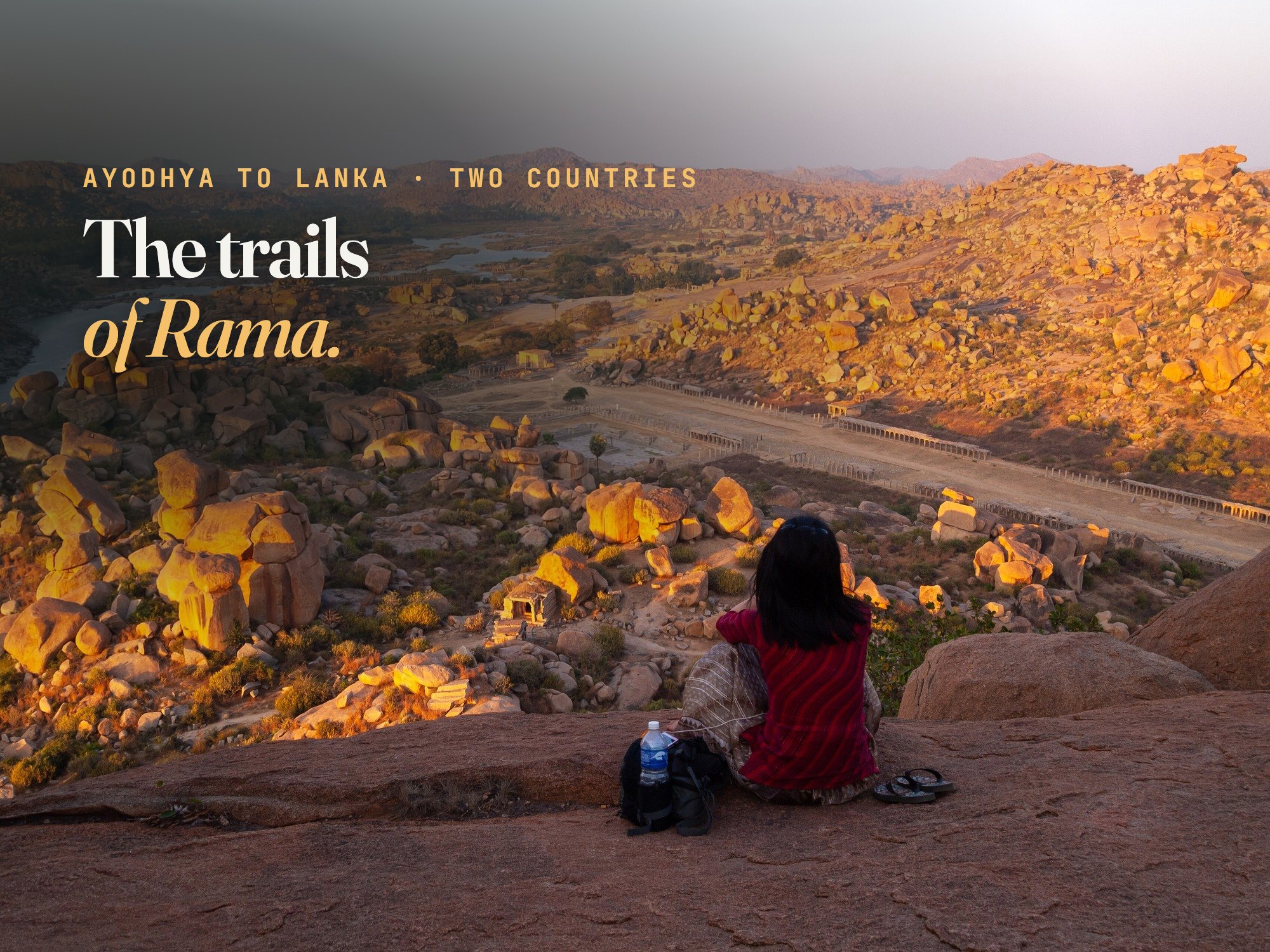
The place today. No landscape on this journey looks more like a myth than the country around Hampi, in Karnataka. Granite boulders the size of houses are piled into hills along the Tungabhadra, as if a giant had been playing with them. Tradition places Kishkindha here, with Anegundi, on the north bank, as its capital. Pampa Sarovar is a lotus pond below the hills, and Anjanadri Hill, whose 570-odd whitewashed steps climb to a small temple, is honoured by many as Hanuman's birthplace (a claim shared with Anjaneri, near Nashik, and Anjanadri in the Tirumala hills). Across the river, in the ruins of Vijayanagara, are the Kodandarama temple and a cave associated with Sugriva.
On TrailX: the Kishkindha Walk: Anjanadri Hill, Pampa Sarovar and Anegundi covers 8.5 km from Hanumanahalli, up and down Anjanadri Hill, past Pampa Sarovar and Vali's cave to Anegundi. New on TrailX.
Plan it: stay in Hampi or Anegundi and hire a bicycle or scooter between the sites. Coracles and small boats cross the river near Hampi when the water allows. Climb Anjanadri for sunset, and avoid the middle of the day from March to May, when the rocks radiate heat. Hampi itself is a UNESCO World Heritage Site.
6. Rameswaram and Rama Setu: where India ends
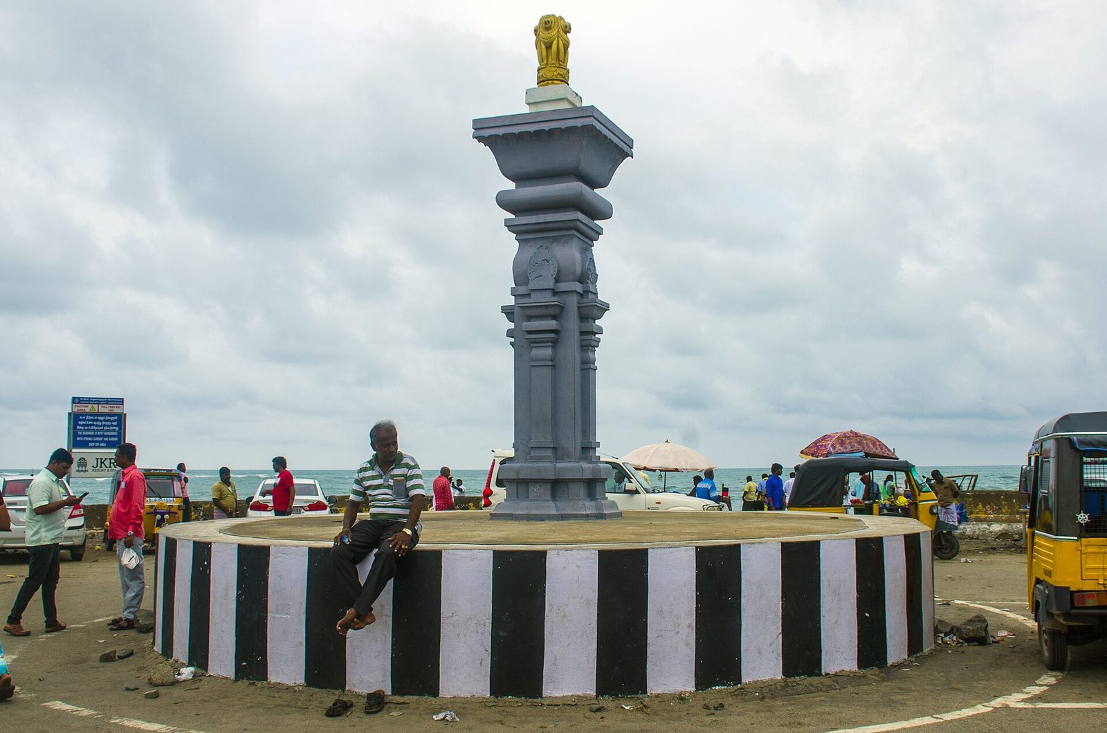 The road's end at Arichal Munai, Dhanushkodi, with the sea beyond · Photo: Rangan Datta Wiki, CC BY-SA 4.0, via Wikimedia Commons
The story. Hanuman leaps across the sea, finds Sita in Ravana's garden and returns. The army marches south to the shore, where, in many tellings, Rama worships Shiva before the war. The vanaras, led by the engineers Nala and Nila, build a bridge of stones across the sea, and the army crosses to Lanka.
The place today. Rameswaram is an island town joined to the mainland by the Pamban bridges. Its Ramanathaswamy temple, one of the twelve Jyotirlingas, is where tradition says Rama worshipped Shiva, and is famous for its immense pillared corridors. East of the town, a spit of land runs out towards Sri Lanka to Dhanushkodi, a town destroyed by a cyclone in December 1964. Its ruins still stand in the sand. Since 2017, a road has run past them to Arichal Munai, the very tip.
On TrailX: the Pamban to Arichal Munai - Dhanushkodi, mapped by TrailX member mk47, drives 35.2 km from Pamban to the land's end, with the sea on both sides for the last stretch. For the temple itself, see our guide to Shiva's trails of India.
The mystery of Rama Setu
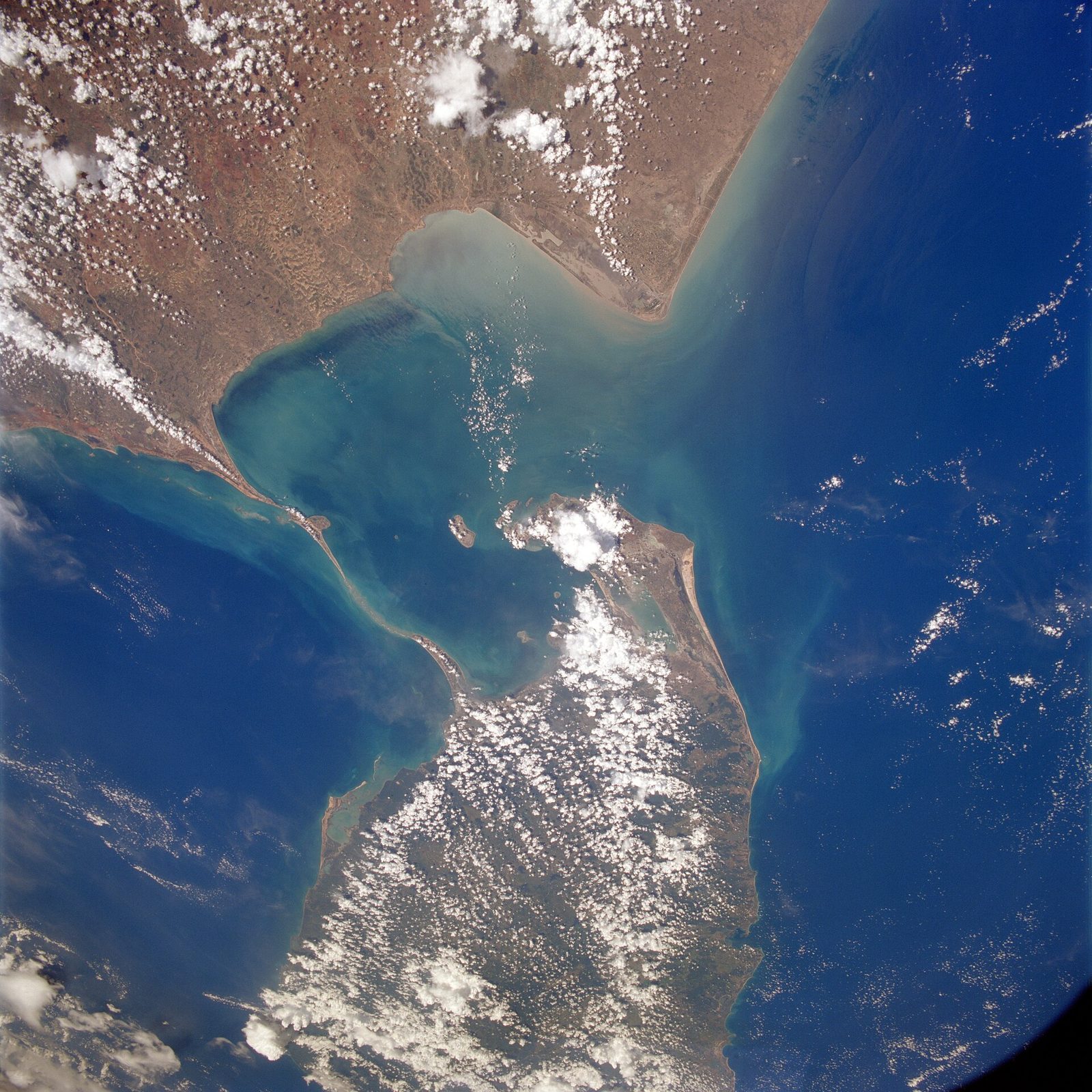 Adam's Bridge from orbit: the chain of shoals between India's Pamban Island and Sri Lanka's Mannar Island · Photo: NASA, public domain
From space, the chain is unmistakable: a line of pale sandbanks and shoals stretching across the Palk Strait from Dhanushkodi to Talaimannar, on Sri Lanka's Mannar Island. Between the two ends there's only about 29 km of water, and much of it is shallow enough to see the sand through.
Its English name, Adam's Bridge, comes from an Islamic tradition about Adam reaching Sri Lanka. In India it's called Rama Setu, Rama's bridge, and for millions of people it is a sacred site. Geologists generally explain the shoals as natural: sand and coral rubble piled up on a shallow ridge by currents and the changing sea level between the two landmasses. The cultural meaning is real and ancient; the legendary origin is a matter of faith, not established science. The question has had practical consequences, too: a plan to dredge a shipping channel through the shoals, the Sethusamudram project, has been stalled for years, partly over its religious significance.
You can't cross it: the shoals straddle the maritime boundary between the two countries, and there's no permitted way for visitors to go out onto them. To see them, stand at Arichal Munai or at the Sri Rama's Bridge viewpoint near Talaimannar, and look out at the line of breaking water.
7. Lanka: the island's own Ramayana
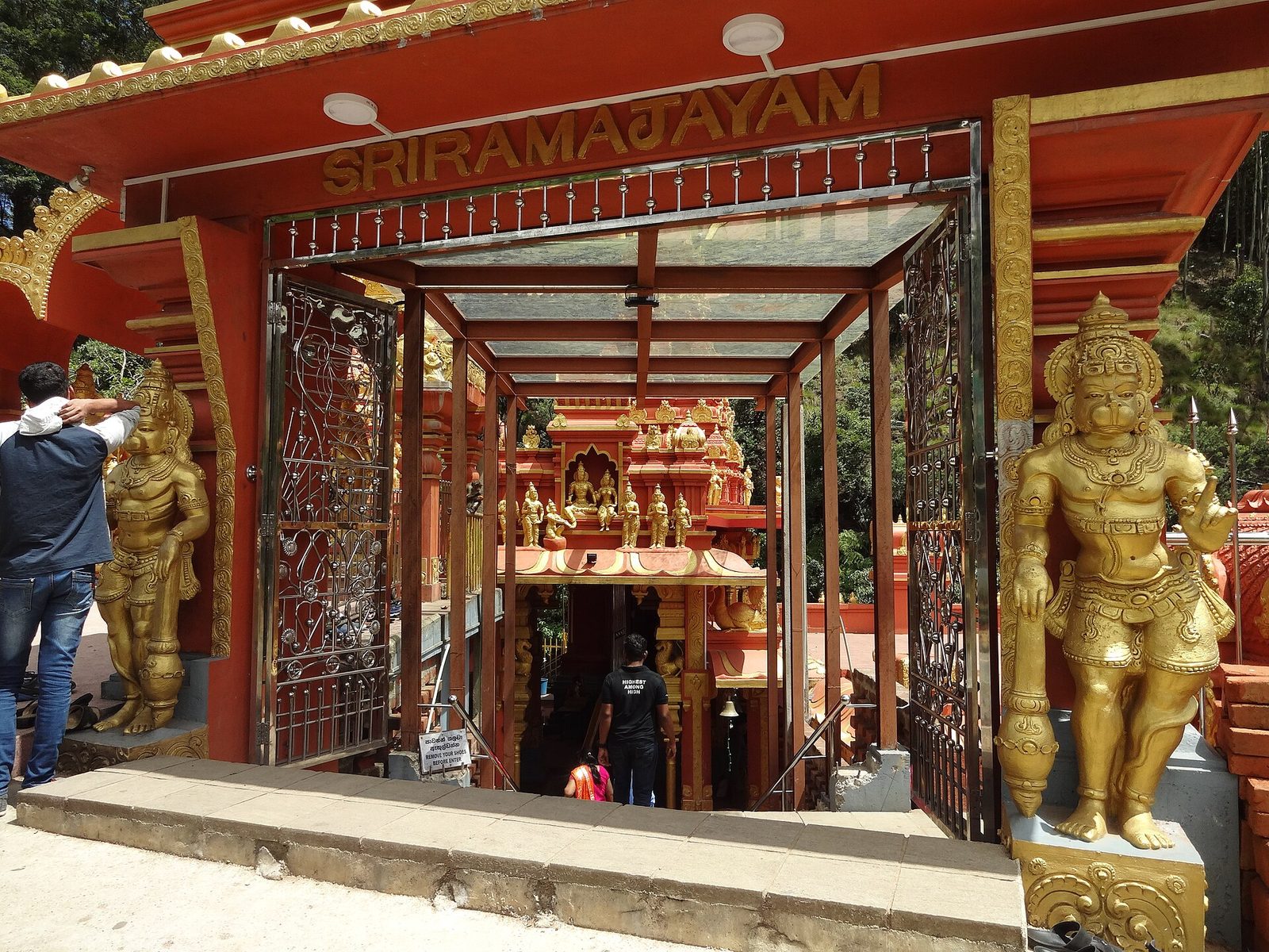 The Seetha Amman temple at Sita Eliya, near Nuwara Eliya · Photo: Z thomas, CC BY-SA 4.0, via Wikimedia Commons
The story. In Lanka, Ravana keeps Sita captive in a garden of ashoka trees and tries to win her over. She refuses. Hanuman finds her there, sets the city alight with his burning tail, and carries her ring back to Rama. In the war that follows, Rama kills Ravana, and Sita is freed.
The place today. Sri Lanka has its own map of the Ramayana, with dozens of sites promoted as a Ramayana Trail by Sri Lanka Tourism, many of them in the cool, misty hill country around Nuwara Eliya.
- Ramboda, on the climb up from Kandy, has a large temple to Hanuman, standing on a ridge above waterfalls and tea estates.
- Sita Eliya, below Hakgala, has the Seetha Amman temple beside a mountain stream, a Tamil Hindu shrine where tradition says Sita prayed and bathed during her captivity. The slopes of Hakgala nearby are identified with the ashoka grove where she was held.
- Divurumpola, off the road towards Welimada, is a temple linked with Sita's trial by fire.
- Ella, in the Uva hills, has Ravana Cave, high in the cliffs above the Ella gap, and Ravana Falls, where the water drops beside the road to Wellawaya.
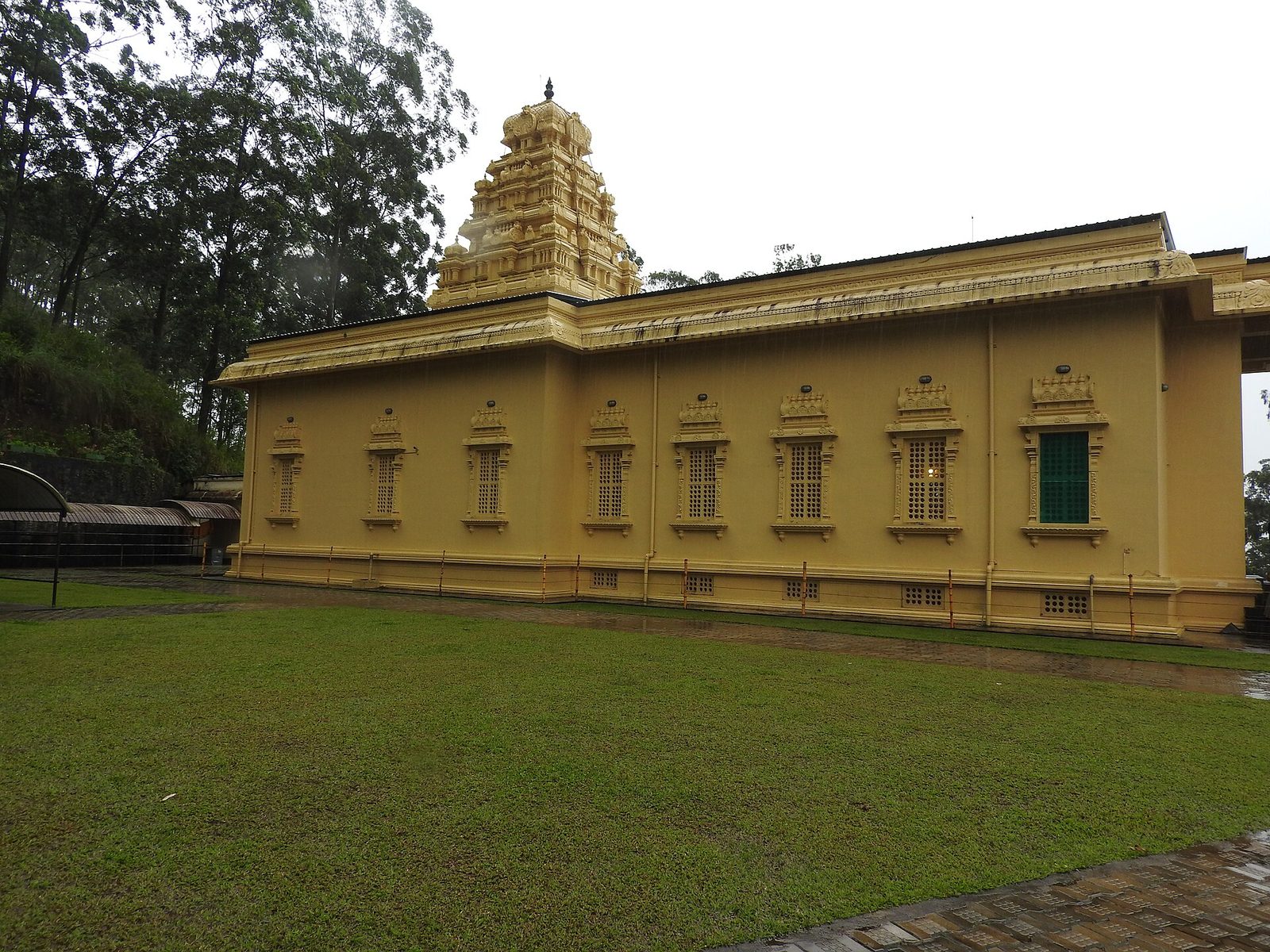 The Bhakta Hanuman temple at Ramboda, in the tea country above Kandy · Photo: Yercaud-elango, CC BY-SA 4.0, via Wikimedia Commons
Two ways to read the story. Who the hero is depends on who's telling it. For Sri Lanka's Hindu community, mostly Tamil, these are pilgrimage sites of the Ramayana as it's told in India. But many Sri Lankans, especially in the Sinhala majority, also know Ravana from other stories: in folklore and in recent popular culture he's often remembered as a powerful and learned king of the island, sometimes as a hero. Not every tradition agrees either. Sigiriya, the rock fortress often called "Ravana's palace" online, was built by King Kashyapa in the 5th century CE, according to the island's chronicles and archaeology. Travelling here is a chance to hear the epic told from the other shore.
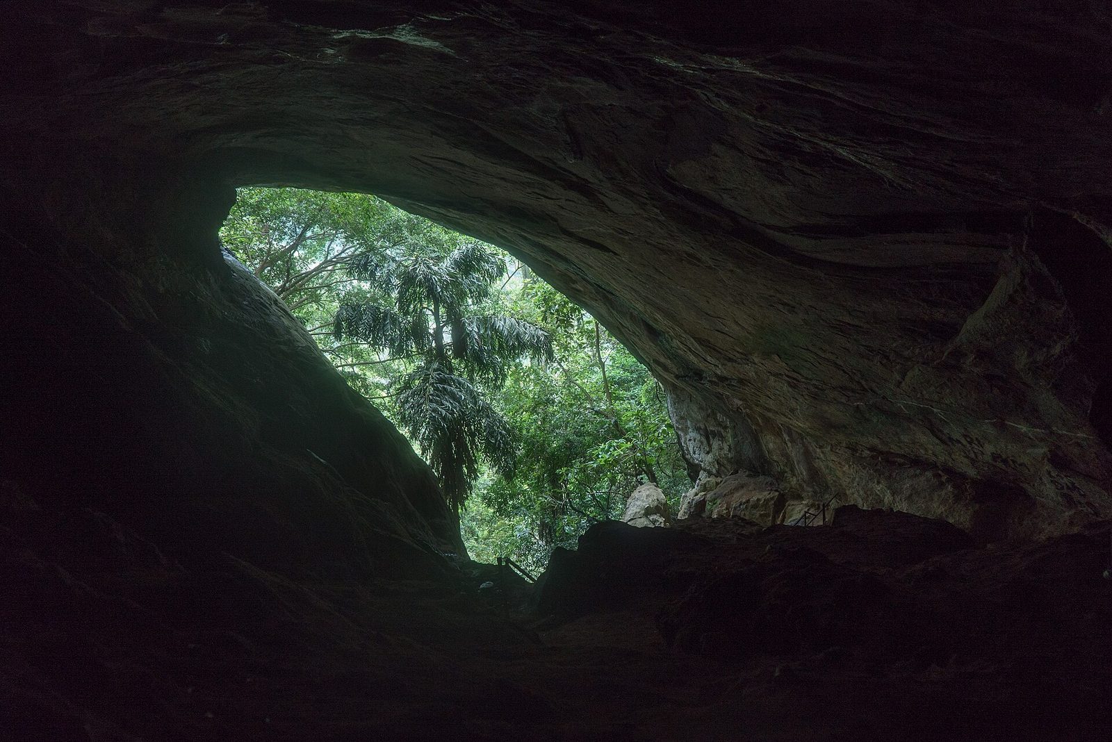 Inside Ravana Cave above Ella, looking out through the cave mouth to the forest · Photo: Alexey Komarov, CC BY-SA 4.0, via Wikimedia Commons
On TrailX: the Sri Lanka Ramayana Trail Drive: Ramboda to Ella covers 85.3 km through the hill country, from the Hanuman temple at Ramboda past Nuwara Eliya, the Seetha Amman temple and Hakgala to Ella and Ravana Falls. From Ella, the Ravana Cave Walk from Ella climbs 2.9 km to the mouth of the cave. Both new on TrailX.
Plan it: many visitors hire a car with a driver. The train from Kandy through Nanu Oya (for Nuwara Eliya) to Ella is one of the most beautiful rail journeys in Asia. The hill country is driest from about January to April.
Plan the journey
- Do it in stages. The whole journey is well over 3,000 km and crosses a border. Most people pick one or two stages: Ayodhya and Chitrakoot from Lucknow or Varanasi; Chhattisgarh from Raipur; Nashik from Mumbai; Hampi from Bengaluru or Goa; Rameswaram from Madurai; the Sri Lankan hill country from Colombo or Kandy.
- Crossing to Lanka. There's no road across the strait. Fly from Chennai, Madurai or another Indian city to Colombo or Jaffna, or check whether the passenger ferry between Nagapattinam in Tamil Nadu and Kankesanthurai near Jaffna is running.
- Pick the season. October to March suits most of the Indian stages. Rameswaram and Dhanushkodi are windy and wet in the northeast monsoon, from October to December. Sri Lanka's hill country is driest from January to April.
- Respect the places. These are living temples. Dress modestly, remove shoes where asked, ask before photographing people or rituals, and follow the rules on cameras and phones.
- Download before you go. Save the GPX from each trail page, or open it in the TrailX app for offline maps and the 3D flyover.
Follow the story
Epics outlive the places they describe. Kingdoms fall, rivers move, forests are cleared. But stand on the steps of Ram ki Paidi at dusk, or at the top of Anjanadri Hill as the boulders turn gold, or at the end of the road at Dhanushkodi with the sea on both sides, and you understand why people have been walking this story for two thousand years.
Open the routes on TrailX, explore them in 3D before you go, and follow the story to the edge of the sea.

Written by
TrailX
Hikers, riders and drivers mapping the world's trails, and sharing what we learn along the way.
Responses