On this page
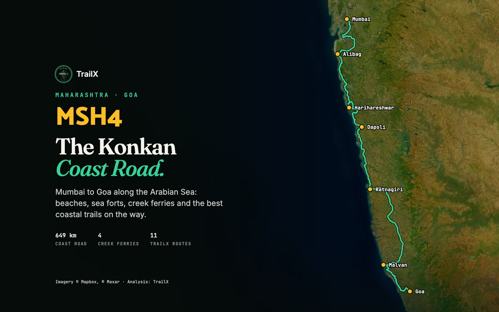
Most people drive from Mumbai to Goa on the NH66, inland, through the hills. The other way to make the trip follows the coast itself: a chain of state highways that hops from beach to fishing village to sea fort, crosses wide tidal creeks by ferry, and rarely loses sight of the Arabian Sea for long. On TrailX it's mapped as one route, MSH4, the Konkan coast road: 649 km from Navi Mumbai to the Goa border.
This guide covers that road, the best short trails along it, and the coastal hikes, rides and drives of Goa at the end of the line. Four of the trails are new on TrailX: we mapped and published them for this guide.
MSH4: the Konkan coast road
Our MSH4 The Konkan coast road route, scouted by fakir27, leaves Vashi in Navi Mumbai and follows the coast through Raigad, Ratnagiri and Sindhudurg districts to Poroscodem on the Goa border.
| Measure | MSH4 on TrailX |
|---|---|
| Distance | 649 km |
| Climbing | ≈3,800 m in total, in short ups and downs over headlands |
| Highest point | ≈242 m |
| Surface | 99% paved |
| Creek ferries | Agardanda–Dighi, Bagmandla–Bankot, Dhopave–Dabhol and Jaigad–Tavsal |
| TrailX difficulty | Moderate |
The road never climbs high, but it's rarely flat or straight. It dips into every creek mouth and climbs over every headland between them, and the total climbing adds up to almost 4,000 m. It's a road to drive slowly.
Where the towns fall
| Town | Distance from Vashi |
|---|---|
| Karanja (Uran) | ≈34 km |
| Alibag | ≈95 km |
| Kashid | ≈126 km |
| Agardanda (ferry to Dighi) | ≈151 km |
| Harihareshwar / Bankot (ferry) | ≈205 km |
| Dapoli | ≈261 km |
| Dabhol (ferry) | ≈290 km |
| Guhagar | ≈305 km |
| Jaigad (ferry to Tavsal) | ≈339 km |
| Ganpatipule | ≈358 km |
| Ratnagiri | ≈379 km |
| Malvan | ≈550 km |
| Vengurla | ≈596 km |
| Goa border (Poroscodem) | ≈638–649 km |
The creek ferries
The Konkan coast is cut by wide tidal creeks, and there are still no bridges across several of them. On the coast road you cross by roll-on roll-off ferry, which is half the fun: you drive onto a flat-decked boat, the creek opens out on both sides, and a short crossing later you're on the other bank.
Our route crosses four creeks this way:
- Agardanda–Dighi, across the Rajpuri creek just south of Murud-Janjira.
- Bagmandla–Bankot, across the mouth of the Savitri river near Harihareshwar.
- Dhopave–Dabhol, across the Vashishti river.
- Jaigad–Tavsal, across the Shastri river at Jaigad.
Bridges are on the way. Maharashtra's Revas–Reddi coastal highway project will replace the creek crossings with bridges along about 500 km of coast, and work has started on several of them: the Agardanda bridge contract was awarded in October 2024, and the Revas–Karanja bridge near Uran is expected around 2028. But as of October 2026 we know of none that have opened, so plan on the ferries.
Ferry tips: services run through the day but thin out in the evening, and they can be suspended in bad weather, especially in the monsoon. Check the last ferry before you set out each morning, carry cash for tickets, and leave time for queues on weekends. If a ferry isn't running, the detour inland can add hours.
A five-day plan
| Day | Stage | Distance | Highlights |
|---|---|---|---|
| 1 | Vashi to Kashid | ≈126 km | Alibag, Kolaba fort at low tide, Kankeshwar |
| 2 | Kashid to Dapoli | ≈135 km | Murud-Janjira, Agardanda and Bankot ferries, Harihareshwar |
| 3 | Dapoli to Ratnagiri | ≈118 km | Dabhol and Jaigad ferries, Guhagar, Ganpatipule, Aare Ware |
| 4 | Ratnagiri to Malvan | ≈171 km | The longest day; Sindhudurg fort and Tarkarli at the end |
| 5 | Malvan to Goa | ≈88 km | Vengurla, then into North Goa |
It can be done faster, but the point of this road is to stop: for a fort, a beach, or a fish thali in a village hotel.
Short trails along the Konkan coast
Alibag: Kolaba fort and Kankeshwar
At low tide you can walk across the sand from Alibag beach to Kolaba fort, the sea fort begun under Shivaji; at high tide it's an island. Check the tide table and don't get caught out on the way back.
North of town, the new Kankeshwar Temple Trek is a short, steep climb of about 2.5 km and 300 m: a long stone staircase (sources count between 650 and 750 steps) up a forested hill to a Shiva temple, with views over Alibag's coconut groves and coast.
Murud-Janjira
Just before the Agardanda ferry, boats run from Rajpuri out to Janjira, the island fort that was never taken by force. The Maharashtra Maritime Board suspends the passenger boats through the monsoon, from late May to the end of August.
Harihareshwar, Velas and Dapoli
Harihareshwar has a temple on the shore and a rocky coast walk around the headland. Across the Bankot creek, the village of Velas holds a turtle festival in the nesting season (usually February to April), when Olive Ridley hatchlings are released to the sea. Dapoli and the beaches around Murud and Harnai are quieter bases for a night.
Ganpatipule and Aare Ware
South of Jaigad, the coast road reaches Ganpatipule and its beachside Ganpati temple. From there to Ratnagiri the road runs high above the sea past the twin beaches of Aare and Ware, one of the best views on the whole coast. We've mapped this stretch as its own short drive: Ratnagiri to Ganpatipule Coast Road, 26 km of cliff road, worth driving even if you skip the rest of MSH4.
Malvan, Sindhudurg and Tarkarli
At Malvan, boats cross to Sindhudurg, Shivaji's great sea fort. Next door, Tarkarli is known for some of the clearest water on the Maharashtra coast and is the state's scuba-diving centre. Both shut down for the monsoon: Sindhudurg's boats typically stop from late May to the end of August, and diving runs roughly from October to May.
North Konkan: Palghar's forts
North of Mumbai, the Palghar coast has two good short fort hikes: Tandulwadi Fort Hike (4.5 km) and Takmak Fort Trek (9.9 km). Both are easy day trips from Mumbai, at their best just after the monsoon, when the hills are green.
The faster way: NH66
If you need to get from Ratnagiri to Goa in a day, the inland highway is quicker. Our NH66 Ratnagiri to Mapusa route, also scouted by fakir27, covers 214 km on the main highway, crossing the Konkan ghats and tidal rivers. Expect heavy truck traffic and construction diversions where the road is being widened.
Goa: islands, estuaries and hidden beaches
MSH4 ends at the Goa border, but the coastal trails don't.
Divar Island by ferry and bike
The new Divar Island Ferry Loop is the most relaxed ride in this guide: a free ferry from Old Goa across the Mandovi, then 10 km of quiet island lanes through paddy fields and old Portuguese-era villages, past the hilltop church at Piedade, and back to the ferry. The ferries are free for foot passengers and two-wheelers. Divar's Bonderam flag festival takes over the island every August.
The estuaries and villages by road
Two drives show off Goa beyond the beaches:
- The Tri Estury Trails South Goa, by fakir27: 58 km from North to South Goa across the Mandovi, Zuari and Sal estuaries.
- Salcete Villages Drive Loop: 51 km through the old villages and churches of Salcete in South Goa.
Butterfly Beach on foot
Butterfly Beach, a small cove between Agonda and Palolem in South Goa, is usually reached by boat. The new Agonda to Butterfly Beach Trail walks there instead: 3.8 km from Agonda village on a lane, then a dirt track, then a narrow forest path down to the beach. Go in daylight; parts of the path are unmarked.
South along the coast
From Goa the coast road carries on into Karnataka. Our Goa–Gokarna Coast Road runs 150 km south to Gokarna, if you're not ready to stop.
When to go
- October to March is the best time for the whole coast: dry, clear and warm, with the sea calm enough for every ferry and fort boat.
- April and May are hot and humid but still open.
- June to September is the monsoon. The coast turns spectacularly green, but fort boats and water sports stop, ferries can be suspended in rough weather, and coastal roads and hill paths get slippery.
All the trails in this guide
| Trail | Type | Distance | Region |
|---|---|---|---|
| MSH4 The Konkan coast road | Drive | 649 km | Navi Mumbai to Goa |
| NH66 Ratnagiri to Mapusa | Drive | 214 km | Ratnagiri to North Goa |
| Ratnagiri to Ganpatipule Coast Road (new) | Drive | 26 km | Ratnagiri |
| Kankeshwar Temple Trek (new) | Hike | 2.5 km | Alibag |
| Tandulwadi Fort Hike | Hike | 4.5 km | Palghar |
| Takmak Fort Trek | Hike | 9.9 km | Palghar |
| Divar Island Ferry Loop (new) | Bike ride | 10.4 km | Old Goa |
| Agonda to Butterfly Beach Trail (new) | Hike | 3.8 km | South Goa |
| The Tri Estury Trails South Goa | Drive | 58 km | North to South Goa |
| Salcete Villages Drive Loop | Drive | 51 km | South Goa |
| Goa–Gokarna Coast Road | Drive | 150 km | Goa to Karnataka |
Every route has a GPX download and works offline in the TrailX app, which is useful on a coast where mobile signal comes and goes between headlands.
Sources
- Free Press Journal on the Revas–Karanja bridge; InfraXpress on the Agardanda creek bridge contract; Swarajya and IndiaInfraHub on the Revas–Reddi coastal highway.
- Maharashtra Maritime Board notices, as reported by UNI, on the monsoon suspension of boats to Janjira.
- Herald Goa on the Divar ferries; Veena World on Butterfly Beach.
- Wikipedia and AlibagOnline on Kankeshwar; Outlook Traveller on Kolaba fort.
- Route geometry from OpenStreetMap via BRouter and Mapbox; satellite imagery © Mapbox and Maxar.
Where to next?

Written by
TrailX
Hikers, riders and drivers mapping the world's trails, and sharing what we learn along the way.
Responses