On this page
Long before there were highways across Ladakh, an army marched over its passes on foot. Between 1834 and 1841, General Zorawar Singh led the troops of Raja Gulab Singh of Jammu from Kishtwar into Ladakh, then into Baltistan, and finally deep into western Tibet, almost to the borders of Nepal. Indian writers often call him the "Napoleon of India".
His campaigns are a story of mountain geography as much as of war. The army crossed glaciers and passes above 4,000 m, wintered in snowbound valleys and fought its last battle at more than 4,500 m in December. Many of the places it passed are on roads and trails you can follow today. We put the campaigns on the map and linked each stretch to the TrailX routes that follow it, including four new routes we mapped for this post.
Who was Zorawar Singh?
Zorawar Singh was born in 1784 (some sources say 1786) in Kahlur, in today's Himachal Pradesh, and rose in the service of Gulab Singh, the Dogra raja of Jammu. The Dogras were vassals of Maharaja Ranjit Singh's Sikh empire, and Gulab Singh was building a mountain kingdom of his own. By the early 1830s Zorawar Singh was the governor (wazir) of Kishtwar, on the Chenab, and Ladakh lay over the mountains to the north.
Ladakh mattered for one reason above all: trade. The fine goat wool called pashm, the raw material of Kashmir's shawls, came from the Tibetan plateau and passed through Leh. Whoever held Ladakh could decide where that trade went. That also explains why the Sikh governor of Kashmir, who wanted the wool to keep coming through Srinagar, later stirred up revolts against the Dogras.
Most of what we know about the first campaign comes from one of Zorawar Singh's own officers. In 1847 Mehta Basti Ram, then governor of Leh, dictated his memories of the war to the British surveyor Alexander Cunningham, who printed them in his book Ladák (1854). We follow his account below. Later histories, such as C. L. Datta's biography, draw on Dogra court sources too, and the dates and place names don't always agree.
The campaigns on today's map
The colours on the map stand for the campaigns: red for Ladakh in 1834–35, amber for Baltistan in 1839–40 and blue for Tibet in 1841. Solid lines are TrailX routes you can follow today. Dashed lines are historical corridors only: they show roughly where the armies went, not a track you can follow, and most of them cross closed borders. Tap a pin for what happened there.
| Campaign | Then | On TrailX today |
|---|---|---|
| Ladakh, 1834–35 | Kishtwar – Warwan – pass at the head of the Suru – Kartse – Pashkum – Mulbekh – Lamayuru – Leh | Warwan Valley trail, Bhot Kol Pass Trek: Warwan Valley to Suru, General Zorawar Singh Route: Suru Valley to Leh |
| Zanskar, late 1835 | Suru – Zanskar | Suru–Zanskar Road |
| Baltistan, 1839–40 | Ladakh – Indus valley – Skardu | Not on TrailX: the road crosses the Line of Control |
| Western Tibet, 1841 | Leh – up the Indus to Hanle and Tashigang; along Pangong Tso to Rudok; Gartok – Tirthapuri – Taklakot | Leh to Hanle Along the Indus, Leh to Chushul via Pangong Tso; in Tibet, the Kailash Heli Yatra Motorable portion |
| Retreat, 1841–42 | Taklakot – passes at the head of the Kali into Kumaon | Kalapani to Lipulekh Pass Expedition |
1834: from Kishtwar over the Bhot Kol
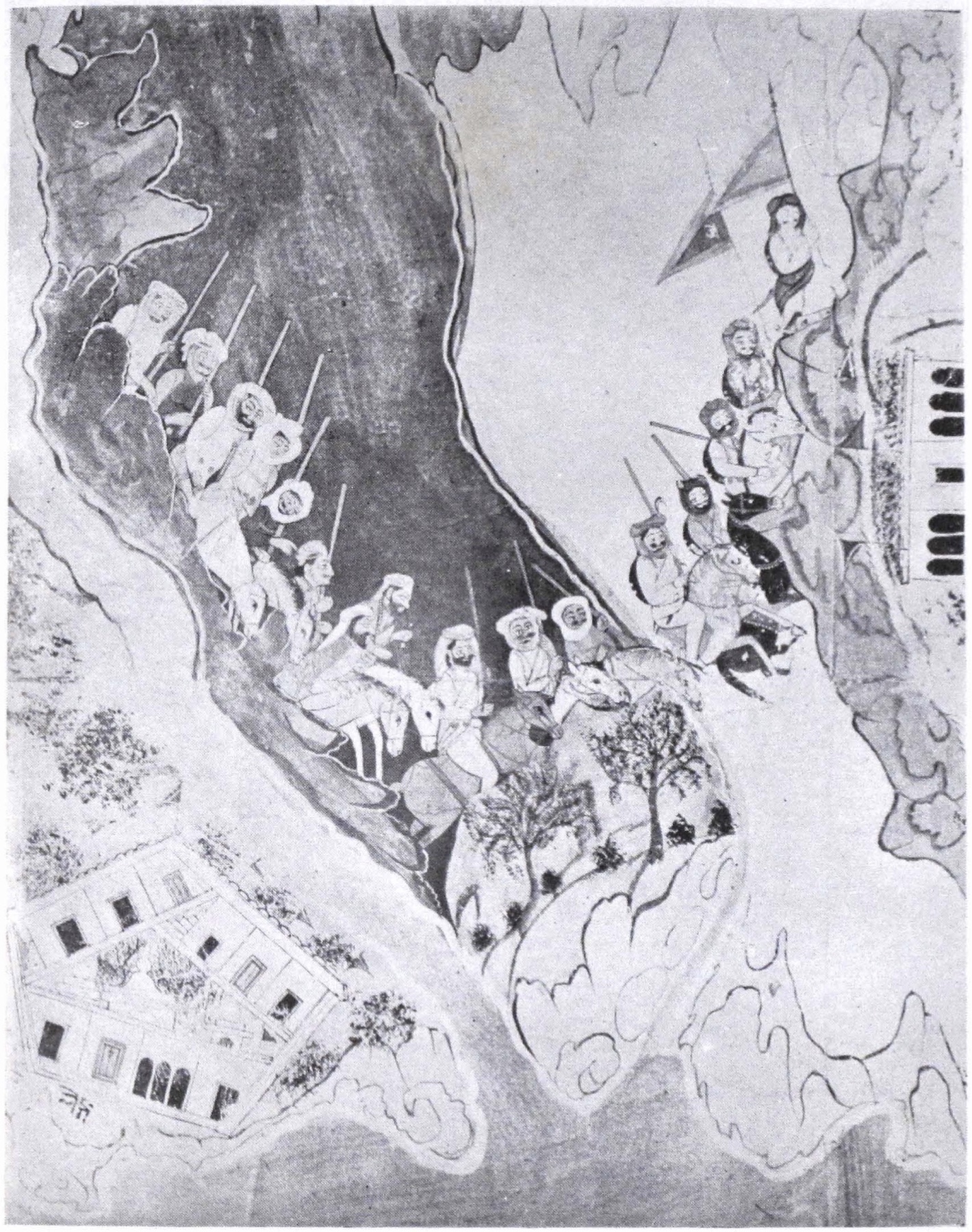 The Dogra army crossing a deep ravine, from a painted scroll of the campaigns made in the 1840s, possibly by Ganga Ram Nakashi · Public domain, via Wikimedia Commons
What happened. In the summer of 1834 the Dogra army, about 5,000 men, marched north from Kishtwar. Rather than go round by Kashmir, which belonged to the Sikh governor, it went straight over the Great Himalaya. Basti Ram remembered "the pass at the head of the Suru valley", which was easy on the north side but "very steep and difficult on the south". Later accounts name it the Bhot Kol (or Bhot Khol), the old crossing from the Warwan valley into the Suru, at about 4,400 m.
On 16 August 1834, on a hill just over the pass, the army met its first resistance: about 5,000 Ladakhis under a leader named Mangal. The hill was held for a whole day before the Ladakhis withdrew. The Dogras then marched down to Suru, where they made a point of not cutting the ripe crops, and the local landowners came over to them.
The place today. The Warwan is one of the most remote valleys in Jammu and Kashmir: a long, green trough of wooden villages under glaciers, reached by a single road. The Bhot Kol crossing from Warwan to the Suru is still a trek of several days over glacier and moraine, with no villages in between.
On TrailX: the Warwan Valley trail, mapped by fakir27, covers 180.2 km from Kishtwar to Inshan, where trekkers register with the police. Today's road goes round by the Sinthan Top and Margan Top passes rather than up the river gorge the army probably followed. From Inshan, our Bhot Kol Pass Trek: Warwan Valley to Suru continues 86.7 km on foot, up the valley past Sukhnai to the meadows at Humpet, over the pass and down to the Suru road near Panikhar. New on TrailX.
1834–35: down the Suru to Leh
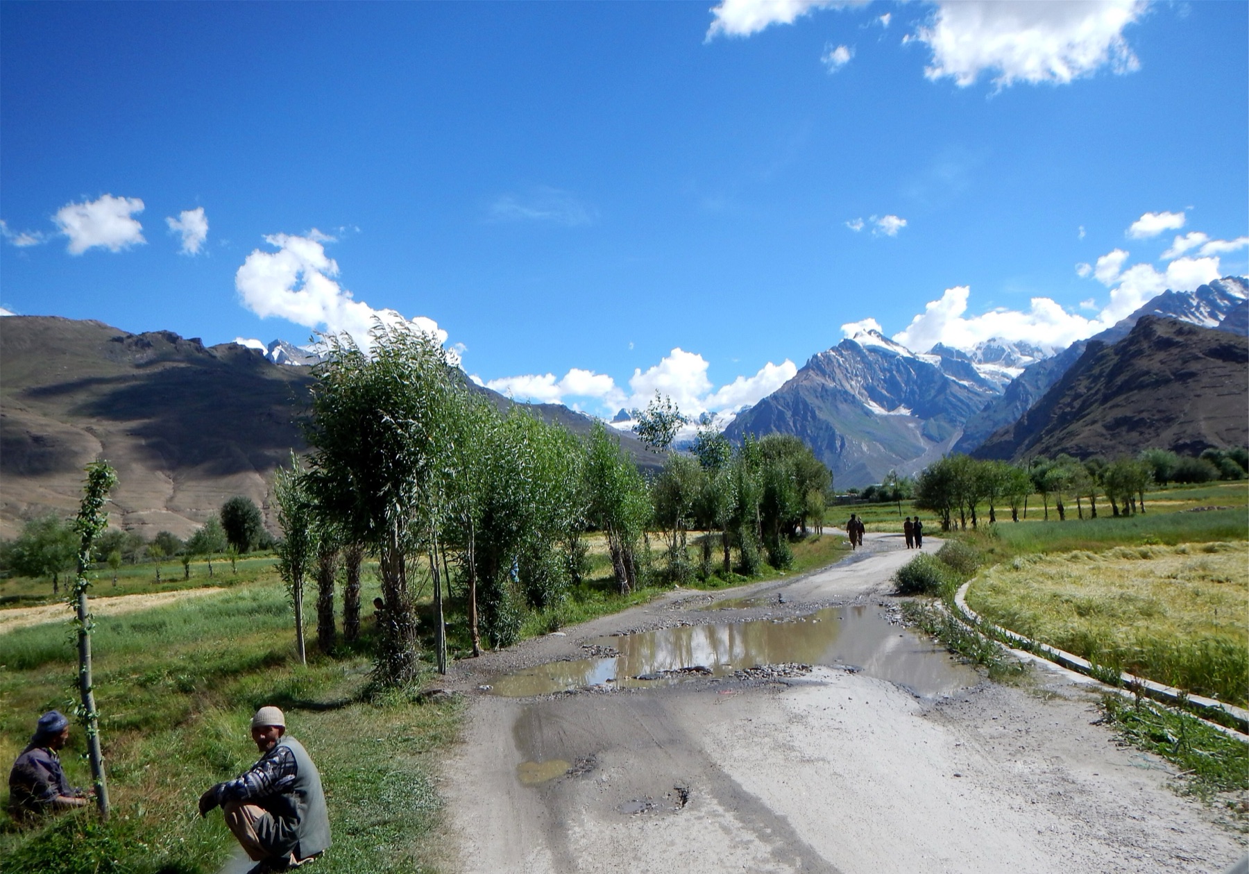 A road through the fields and poplars of the Suru valley, with snow peaks behind · Photo: Kashmir photographer, CC BY-SA 4.0, via Wikimedia Commons
What happened. From the Suru valley the army moved down towards Kargil, into the district then called Purig. At Pashkum, the Ladakhis broke the bridge over the Wakha river, which can't be forded there. The next day the Dogras crossed on inflated animal skins, and the chief of Pashkum fled to his fort at Sod. That fort fell to a dawn assault after ten days of firing.
Meanwhile the king (gyalpo) of Ladakh had gathered an army of about 22,000 at Mulbekh. His general, Banka Kahlon, worked round behind the Dogras and cut them off, and Zorawar Singh had to retreat to the fort of Thai Sultan at Langkarchu, near today's Kartse in the Suru valley. The army spent four months there, cut off by snow. In spring 1835 the Ladakhi army came through the snow to attack. Exhausted, it stopped to make tea before fighting, and the Dogras charged and routed it.
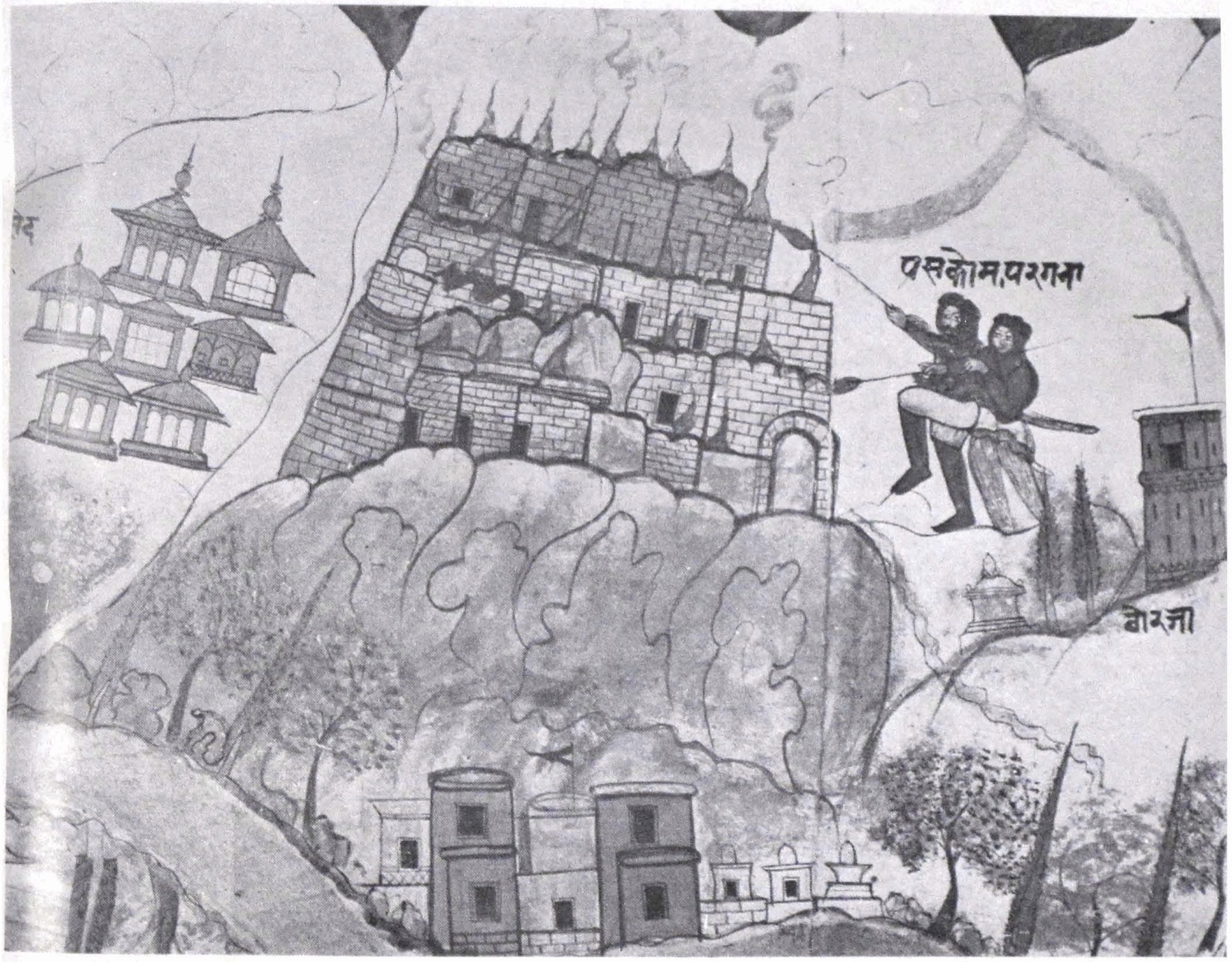 The setting on fire of Pashkum fort, from the 1840s painted scroll of the campaigns · Public domain, via Wikimedia Commons
Then the road to Leh was open. Using prisoners as porters, the army marched back to Pashkum and on by Shergol to Mulbekh, where it halted for 15 days, then by Kharbu to Lamayuru. There an envoy from the king met them, asking for peace. The king met Zorawar Singh on the plain at Basgo, and Ladakh agreed to pay 50,000 rupees for the cost of the war and a yearly tribute of 20,000. When revolts broke out over the next two years, Zorawar Singh came back each time. In 1836 he built a fort outside Leh, with a garrison of 300 men.
The place today. This is the easiest part of the story to follow. The Suru road runs from Panikhar past Sankoo and Kartse, where a Maitreya Buddha is carved into a boulder, to Kargil. From Kargil the Srinagar–Leh highway follows almost exactly the army's line of 1835: Pashkum, Mulbekh with its 9 m rock-cut Maitreya, the Namika La and Fotu La passes, the eroded "moonland" at Lamayuru, the ruined palace at Basgo, and Leh. The Dogra fort still stands in Leh, south of the old town, and holds a small museum.
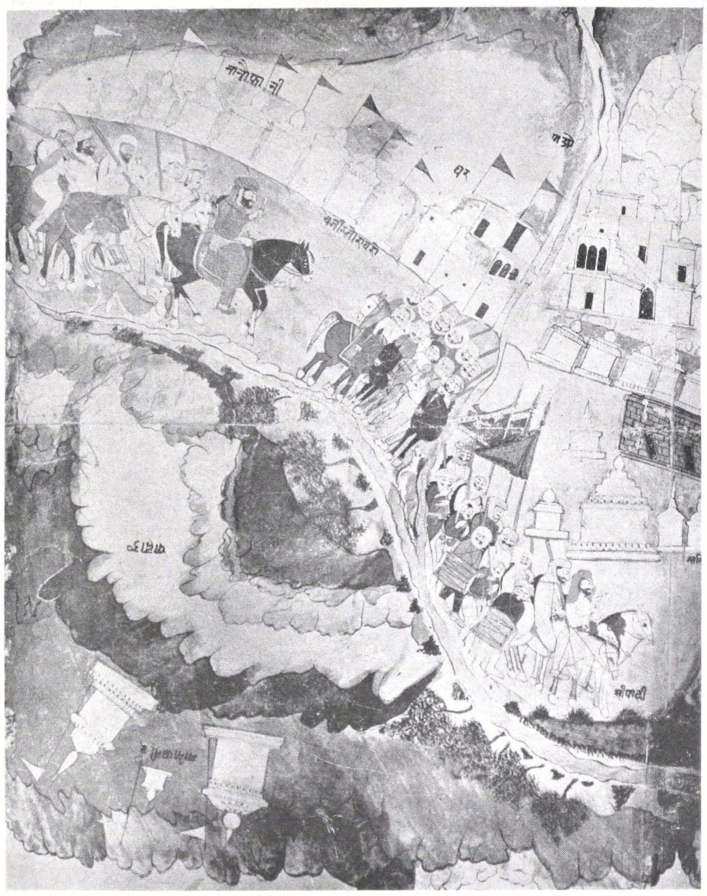 The Dogras entering Leh, from the 1840s painted scroll of the campaigns · Public domain, via Wikimedia Commons
On TrailX: the General Zorawar Singh Route: Suru Valley to Leh drives 280.6 km from Panikhar through every stop of the 1834–35 march and ends at the Zorawar Fort in Leh. New on TrailX. For the whole highway from Srinagar, see the Srinagar–Leh Highway. Late in 1835, Zorawar Singh also marched from the Suru into Zanskar and made its chief pay tribute. The Suru–Zanskar Road covers 252.2 km from Kargil to Padum.
1839–40: Baltistan
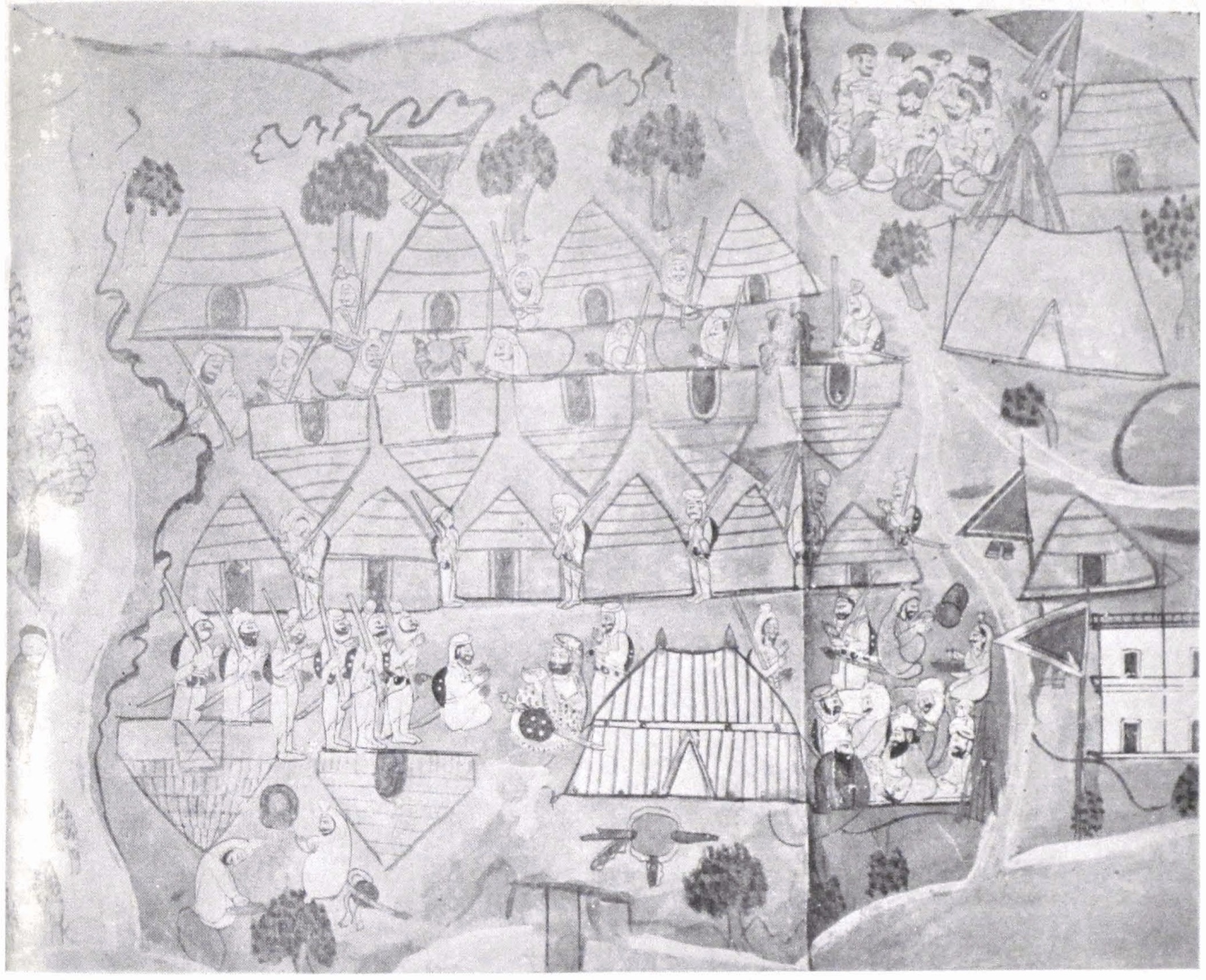 Ahmad Shah of Baltistan brought before Wazir Zorawar Singh, from the 1840s painted scroll of the campaigns · Public domain, via Wikimedia Commons
What happened. In the winter of 1839–40 Zorawar Singh invaded Baltistan, the Balti kingdom down the Indus around Skardu. An advance brigade lost its way in the snow, but the main army reached Skardu. Ahmad Shah, the ruler of Baltistan, shut himself in the fort, and surrendered when its water ran out. Zorawar Singh put Ahmad Shah's son Muhammad Shah on the throne in return for a yearly tribute of 7,000 rupees, and took Ahmad Shah with him as a prisoner.
The place today. Skardu is in Gilgit-Baltistan, administered by Pakistan, and the old route down the Indus from Kargil crosses the Line of Control. There's no way to follow it today, so it appears on the map only as a dashed line.
1841: into western Tibet
What happened. In May 1841, with an army of about 5,000 Dogra, Ladakhi and Balti soldiers, Zorawar Singh turned east, towards the Tibetan provinces of Rudok and Ngari. Old Ladakhi kings had once ruled there, and the region produced the finest shawl wool. The army moved in separate columns. One went up the Indus and plundered the monasteries at Hanle and Tashigang. Zorawar Singh led his own column along Pangong Tso towards Rudok. Rudok and Gartok, the seat of the Tibetan governors, both submitted without a fight. The army crossed the sources of the Indus and set up headquarters at Tirthapuri, on the Sutlej near Mount Kailash. On 6 September it stormed Taklakot (today's Purang), near the borders of Nepal and Kumaon, and Basti Ram was left in charge there.
Then winter came, and so did an army from Lhasa. In November two Dogra detachments sent to stop it were cut to pieces. Zorawar Singh marched out from Tirthapuri with everything he had. The armies met near To-yo, just north of Taklakot, on 10 December, and fought for three days at more than 4,500 m, in the depth of winter. Many of the Indian soldiers had lost the use of their fingers and toes to frostbite, and some had burned the stocks of their muskets for warmth. On 12 December 1841 Zorawar Singh was hit in the shoulder, fell from his horse and was killed. His army broke. Of about 6,000 men, including camp followers, Cunningham reckoned that no more than 1,000 survived. The garrison at Taklakot fled over the passes at the head of the Kali river into Kumaon, and half of them died of cold on the way.
What came after. In spring 1842 a Tibetan army marched into Ladakh and besieged the fort at Leh. Dogra reinforcements under Diwan Hari Chand drove it back, and in August 1842 it was defeated near Chushul. On 17 September 1842 the two sides agreed to peace in Leh. The agreement is usually called the Treaty of Chushul, and it restored the old border between Ladakh and Tibet. Four years later, Ladakh became part of Gulab Singh's new state of Jammu and Kashmir.
The places today. The Indian side of the 1841 routes runs through Changthang, the high plateau of eastern Ladakh. Everything east of it, including Tashigang, Rudok, Gartok and Taklakot, is in the Tibet Autonomous Region of China, across the Line of Actual Control. There are no crossings there. Near To-yo, a chorten on a hill above the village is remembered as Zorawar Singh's samadhi. Indian pilgrims on the Kailash Mansarovar Yatra, run by India's Ministry of External Affairs, enter Tibet over the Lipulekh pass and pass through Taklakot. In 2026 the yatra ran from June to August, with ten batches crossing at Lipulekh.
On TrailX:
- The Leh to Hanle Along the Indus drives 259.0 km up the Indus from Leh, the line of the 1841 Indus column, past Chumathang and Nyoma to the monastery at Hanle. New on TrailX. From Hanle, the Umling La Road reaches Demchok, the last village on the Indian side, across the river from Tashigang.
- The Leh to Chushul via Pangong Tso drives 203.2 km over the Chang La to Pangong Tso and along its southern shore to Chushul, the way Zorawar Singh's own column went towards Rudok in 1841 and the Tibetan army retreated in 1842. New on TrailX. The Tangtse to Durbuk - Pangong Loop, mapped by TrailX member vkbisht, loops round the lake's western end, and the Chushul to Mahe - Kaksang La links Chushul with the Indus at Mahe.
- In Tibet, the Kailash Heli Yatra Motorable portion runs from the Nepal border through Taklakot, past To-yo, to Lake Manasarovar and Mount Kailash.
- The Kalapani to Lipulekh Pass Expedition climbs to the Lipulekh pass at the head of the Kali, close to where the Taklakot garrison escaped into Kumaon in December 1841.
Can you follow Zorawar Singh's routes today?
In part. The 1834–35 route is the most complete: you can trek the Warwan and the Bhot Kol, drive the Suru valley, and follow the Srinagar–Leh highway through Pashkum, Mulbekh and Lamayuru to the fort at Leh. The Indian ends of the 1841 routes, up the Indus to Hanle and along Pangong Tso to Chushul, are open too, with permits. Baltistan and the Tibetan stretches are closed to travel across the borders, except for Indian pilgrims on the Kailash Mansarovar Yatra.
These are historical corridors, not GPS tracks. Nobody recorded the army's exact path, and sources disagree on dates, names and which column went where. Our TrailX routes follow today's roads and paths through the places the accounts name.
Planning a trip
- Season. The Bhot Kol is passable from about July to September. The Suru road and the Srinagar–Leh highway are usually open from May to November, and the roads to Pangong and Hanle from May to October, though the Chang La can get snow in any month.
- Altitude. Leh is at about 3,500 m, Pangong Tso about 4,250 m and the Chang La about 5,360 m. Spend at least two nights in Leh before you go higher, and don't sleep higher than you need to on the first nights.
- Permits. The Warwan and the Kargil–Leh highway need no permit, but register with the police at Inshan before the trek. Pangong, Chushul and the Indus valley beyond Upshi are protected areas: Indian citizens register and pay an environment fee on the LAHDC Leh permit portal, and foreign nationals need a Protected Area Permit through a registered agency in Leh. Hanle and the roads near the Line of Actual Control have extra restrictions, especially for foreigners.
- Fuel and supplies. Fill up in Kargil and Leh. Beyond Upshi and Tangtse, pumps are few and far apart, so carry spare fuel. On the Bhot Kol, there's nothing between Humpet and Panikhar: take a local guide and pack animals.
- Read before you go. Cunningham's Ladák (1854) is free to read online and has Basti Ram's account in full. For background on crossing the high passes, see our guide to crossing Himalayan mountain passes and our list of the mountain passes of India.
The legacy of General Zorawar Singh
Zorawar Singh's campaigns redrew the map of the western Himalaya. Ladakh and its trade routes passed from an independent Buddhist kingdom to the Dogras of Jammu, and in 1846 became part of the state of Jammu and Kashmir. In Jammu and Himachal he is remembered as a hero, and his name is on the fort in Leh and on roads. In July 2024, DRDO and L&T unveiled a light tank built for the high mountains of Ladakh, and named it Zorawar after him. In Ladakh and Baltistan the conquest is remembered as something else: years of war, heavy taxes, plundered monasteries and the end of the old kingdoms.
Either way, the routes he took tell you a lot about the Himalaya. The army crossed these mountains on foot, in all seasons, without maps, and lost more men to cold than to fighting. Next time you drive past the Maitreya at Mulbekh or stop below the monastery at Lamayuru, remember that an army once passed this way too.
Planning a different kind of history trip? See how the old London to Calcutta bus route looks today, or follow the ancient trade routes of silk, salt and spice.
Written by
fakir27
TrailX scout with more than 90 mapped routes, from the Trans Uttarakhand Shiva Trail to the roads to Kailash and Lipulekh.
Responses