On this page
- 01How do you measure a mountain without GPS?
- 02The Great Trigonometrical Survey
- 03Radhanath Sikdar, the human computer
- 04Peak XV: what Sikdar did, and what we don't know
- 05The pundits: explorers in disguise
- 06Nain Singh Rawat: the pundit of pundits
- 07Nain Singh's journeys on today's map
- 08Other pundits worth knowing
- 09Then and now
- 10Following in their footsteps today
- 11Their legacy
Today you can open a map of the Himalaya on your phone and see every pass, glacier and village, with your own position as a blue dot. A hundred and seventy years ago, much of that map was blank. The heights of the great peaks were unknown, nobody outside Tibet knew where its rivers went, and the position of Lhasa was a guess.
The people who filled in the blanks worked for the Great Trigonometrical Survey of India. Some sat at desks in Dehradun and Calcutta and turned thousands of angles into heights and distances. Others walked into Tibet in disguise, counting every step on a string of prayer beads. Two of them are the subject of this post: Radhanath Sikdar, a mathematician from Calcutta, and Nain Singh Rawat, a schoolteacher from a high Kumaon village who became the most famous of the Survey's secret explorers.
We tell their stories, put Nain Singh's journeys on the map and link the stretches you can still follow to TrailX routes.
How do you measure a mountain without GPS?
With triangles. If you know the length of one side of a triangle and two of its angles, you can work out the rest. Surveyors measured one line on the ground very carefully, called a baseline, and then built a chain of triangles out from it, measuring only angles between hilltops and towers. Each new triangle borrowed a side from the last one, so the chain could run for hundreds of kilometres.
The same trick works for a mountain you can never reach. Take sightings of the summit from two or more known stations, measure the angle up to it, and you can calculate both its position and its height. The hard part is everything else: the curve of the Earth, the way air bends light near the horizon, the pull of the mountains on the plumb line, and the sheer amount of arithmetic.
The Great Trigonometrical Survey
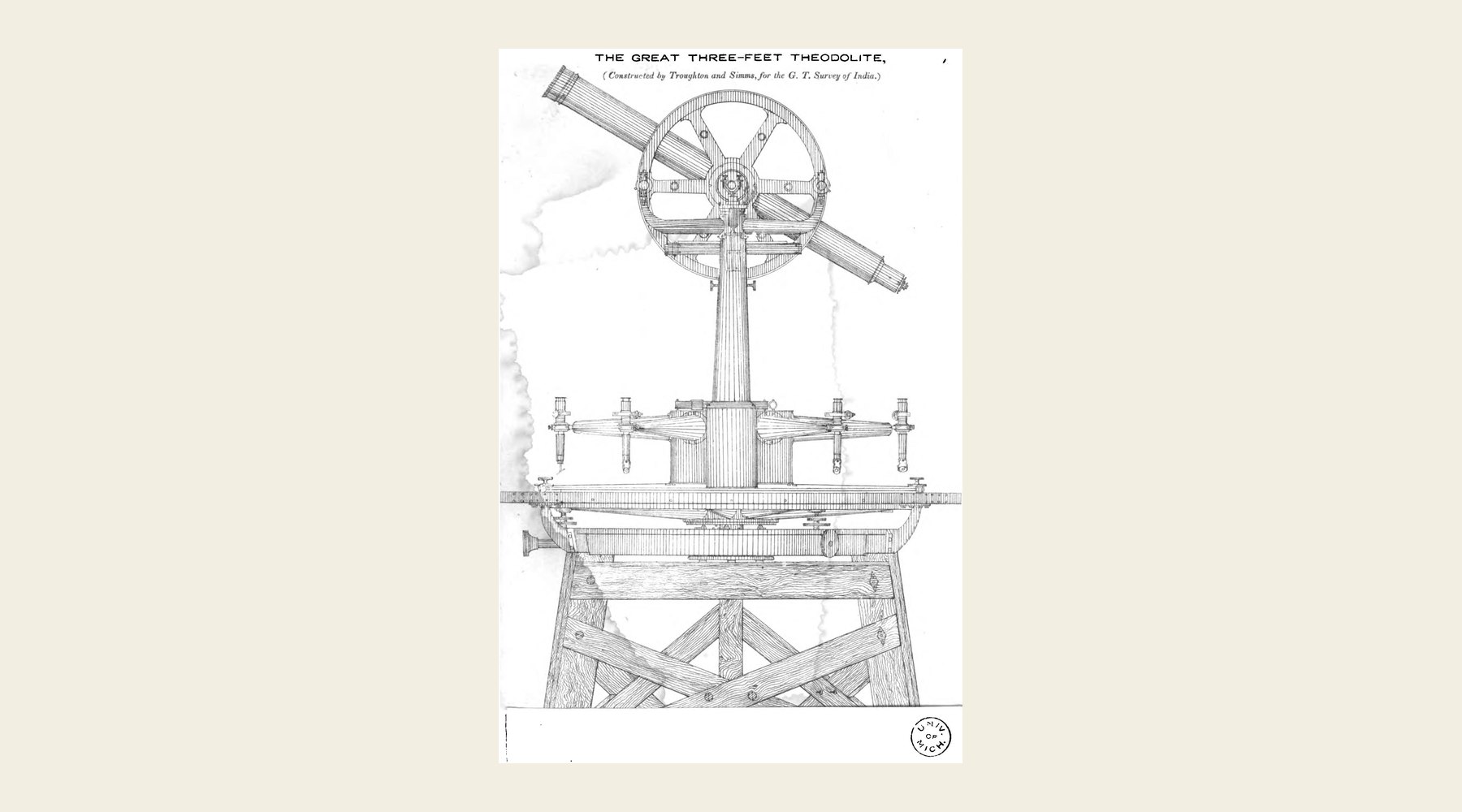 A great three-foot theodolite of the kind the Survey used, from an engraving of 1865 · Professional Papers on Indian Engineering, vol. 2 (1865) · Public domain, via Wikimedia Commons
The Survey began on 10 April 1802, when William Lambton, an infantry officer, started measuring a 7.5-mile baseline near St Thomas Mount in Madras. His main instrument, the great theodolite, weighed about half a ton and needed twelve men to carry it. Lambton spent the rest of his life on the work and died in 1823 at Hinganghat, in central India, still in the field.
His successor, George Everest, ran the Survey from 1823 to 1843 and completed the Great Arc of the Meridian: a chain of triangles about 2,400 km long, from Cape Comorin at the southern tip of India to Mussoorie in the Himalayan foothills. Teams cut through forest, built masonry towers on the plains so they could see over the haze, and lost many men to malaria. The Company had expected the Survey to take about five years. It took nearly seventy, and was declared complete in 1871.
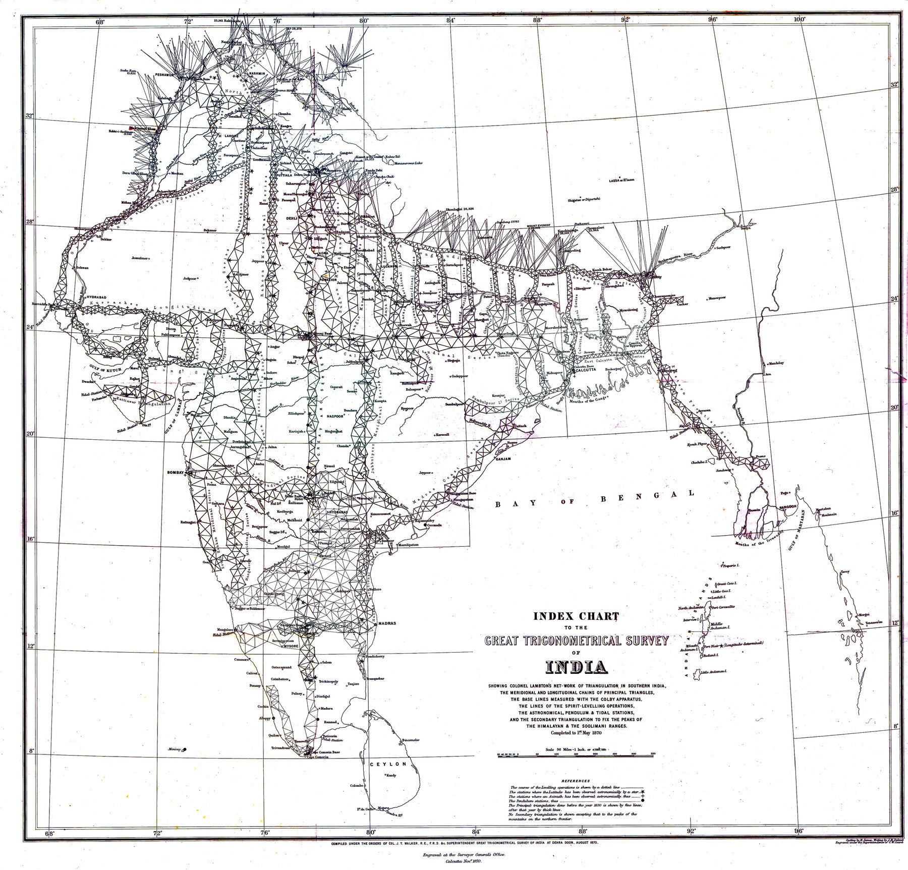 Index chart of the Great Trigonometrical Survey, 1870: chains of triangles cover India, ending along the Himalaya · Survey of India · Public domain, via Wikimedia Commons
Along the way it produced the first accurate measurements of the Himalaya. Surveyors on the plains of north India sighted the snow peaks from distances of 150 km and more, and numbered the ones they could not name. One of them was Peak XV.
Radhanath Sikdar, the human computer
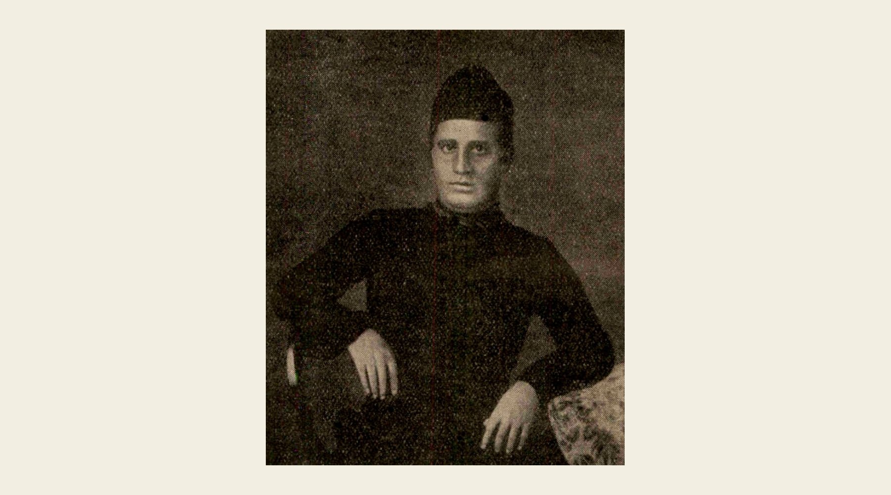 Radhanath Sikdar, from a portrait printed in The Modern Review in 1941 · Public domain, via Wikimedia Commons
Radhanath Sikdar was born in Jorasanko, Calcutta, on 5 October 1813. At Hindu College he was a star pupil of the mathematician John Tytler, and on 19 December 1831 he joined the Survey as a "computer", the job title for the people who did the calculations, on 30 rupees a month. He was sent to Sironj, on the Great Arc in central India, and became one of George Everest's most valued assistants.
Sikdar's work was the hidden half of the Survey: turning field observations into positions and heights, correcting for the Earth's shape and for refraction, and checking each triangle against the next. The Survey's handbook for its staff, the Manual of Surveying for India (1851), credited him in its preface with its most technical and mathematical chapters. In 1851 he became Chief Computer and moved to the Survey's office in Calcutta, where he also ran the meteorological observations.
He was not a quiet employee. In 1843 he was fined 200 rupees for standing up to a magistrate who had mistreated the Survey's workers. In 1854, with his friend Peary Chand Mitra, he started Masik Patrika, a Bengali magazine in plain language aimed at women readers. He retired in 1862, taught mathematics at the General Assembly's Institution in Calcutta, and died at Chandernagore on 17 May 1870. When the Manual was reprinted in 1875, the preface with his name had been dropped. A Calcutta paper called it "robbery of the dead".
Peak XV: what Sikdar did, and what we don't know
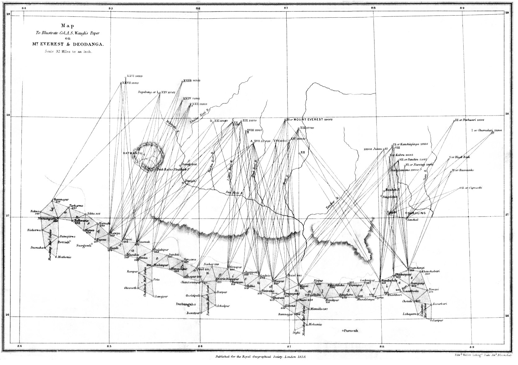 Andrew Waugh's 1858 map of the Survey's sight lines to the peaks of Nepal: dozens of rays from stations on the plains meet at "Mount Everest" · Royal Geographical Society · Public domain, via Wikimedia Commons
The best-known story about Sikdar is that he burst into the office of the Surveyor General, Andrew Waugh, and announced: "Sir, I have discovered the highest mountain on Earth." It is a good story. It is also very probably not true, and it is worth knowing why.
Here is what the records show. Surveyors observed Peak XV from six stations on the plains between 27 November 1849 and 17 January 1850. Each sighting was worked out separately, and gave heights between 28,990 and 29,026 ft. Their average, 29,002 ft (8,840 m), made it the highest peak known, ahead of K2 and Kangchenjunga. Waugh announced the result in 1856 and proposed naming the peak after his predecessor. George Everest himself objected: in 1857 he told the Royal Geographical Society that his name could not be written in Hindi or easily pronounced by the people of India. The Society adopted "Mount Everest" anyway in 1865. The local names, Chomolungma in Tibetan and Sagarmatha in Nepali, are much older.
Here is what is disputed. By the time the Himalayan observations came in, Sikdar was working in Calcutta, while the snow-peak computations were done at Dehradun, in an office run by J. B. N. Hennessey. The link to Sikdar rests on a remark by the surveyor Sidney Burrard in Nature in 1904, that "about 1852 the chief computer" in Calcutta told Waugh that Peak XV was the highest. The dramatic quote first appears much later: a British officer, Kenneth Mason, repeated it in a speech in 1928, attributing it to an unnamed "babu", or clerk, and a Bengali writer, Jogesh Chandra Bagal, attached it to Sikdar in 1933. Historians have argued about it ever since. Some, such as John Keay in The Great Arc, doubt the scene but think Sikdar's calculations may well have played a part. Others find no evidence that he worked on Peak XV at all.
The fair summary: Sikdar was one of the finest mathematicians the Survey ever had, and his work underpinned its maps. Whether he personally showed that Peak XV was the highest mountain in the world is not proven. He does not need the legend to deserve his place in the story.
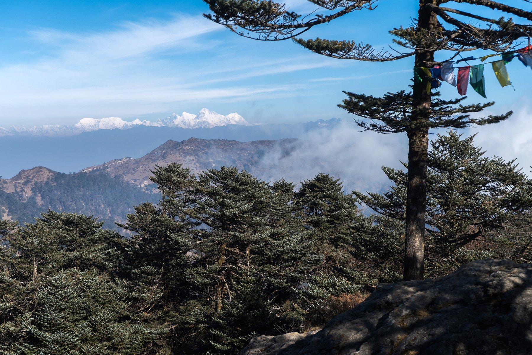 Lhotse, Everest and Makalu on the skyline, seen from Sandakphu in Darjeeling · Photo: Alexkom000, CC BY 4.0, via Wikimedia Commons
On TrailX: you can still see Peak XV from India, much as the surveyors did. The Manebhanjan to Sandakphu Land Rover Road climbs 31.1 km to Sandakphu (3,636 m) on the Nepal border, where Everest, Lhotse and Makalu line up on the north-western skyline, and the Sandakphu to Phalut Ridge Trek carries on along the ridge. To stand at the foot of the mountain itself, see the Everest Basecamp trail.
The pundits: explorers in disguise
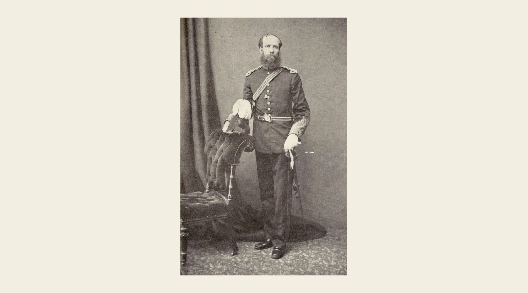 Thomas George Montgomerie, the Survey officer who trained the pundits · Public domain, via Wikimedia Commons
By the 1860s the Survey had mapped British India up to the Himalaya, but Tibet beyond it was closed. Europeans who tried to enter were turned back. Yet people from the border valleys crossed every summer to trade, and some of them could read, write and do arithmetic.
In 1861 Thomas Montgomerie, an officer of the Survey, proposed training such men as secret surveyors. The plan was approved, and the recruits became known as the pundits, after the code name of the first and greatest of them, Nain Singh. About twenty were trained at Dehradun over the following decades. They learned to:
- Walk at an exact pace. They practised until every pace was the same length, 2,000 to the mile, uphill or down.
- Count without being seen. A Buddhist rosary has 108 beads. Theirs had 100, with every tenth bead larger. They slipped one bead for every 100 paces, so one full turn of the rosary meant 10,000 paces, or five miles.
- Hide their notes. Bearings and pace counts were written on rolls of paper hidden inside a prayer wheel. A small compass could go in the wheel or in a hollow walking stick.
- Find latitude by the stars, with a sextant, using mercury poured into a bowl as an artificial horizon.
- Find altitude by boiling water. Water boils at a lower temperature the higher you go. A thermometer and a pot of boiling water were enough to work out the height.
In the Survey's printed reports they appeared only as initials or code names. Their own names stayed secret for years.
Nain Singh Rawat: the pundit of pundits
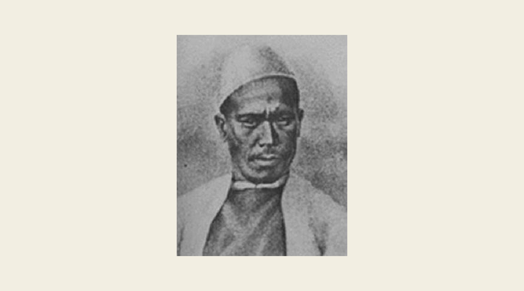 Nain Singh Rawat · Public domain, via Wikimedia Commons
Nain Singh was born in about 1830 in Milam, a trading village at 3,400 m in the Johar valley of Kumaon, near the snout of the Milam glacier. The people of Johar spent summers in Milam and traded over the passes into Tibet, so he grew up speaking Tibetan and knowing its customs. In 1856 he travelled to Ladakh with the German brothers Schlagintweit and learned to use survey instruments. When Montgomerie went looking for recruits, Nain Singh, by then a village schoolmaster, and his cousin Mani Singh were recommended. They trained in Dehradun for about two years.
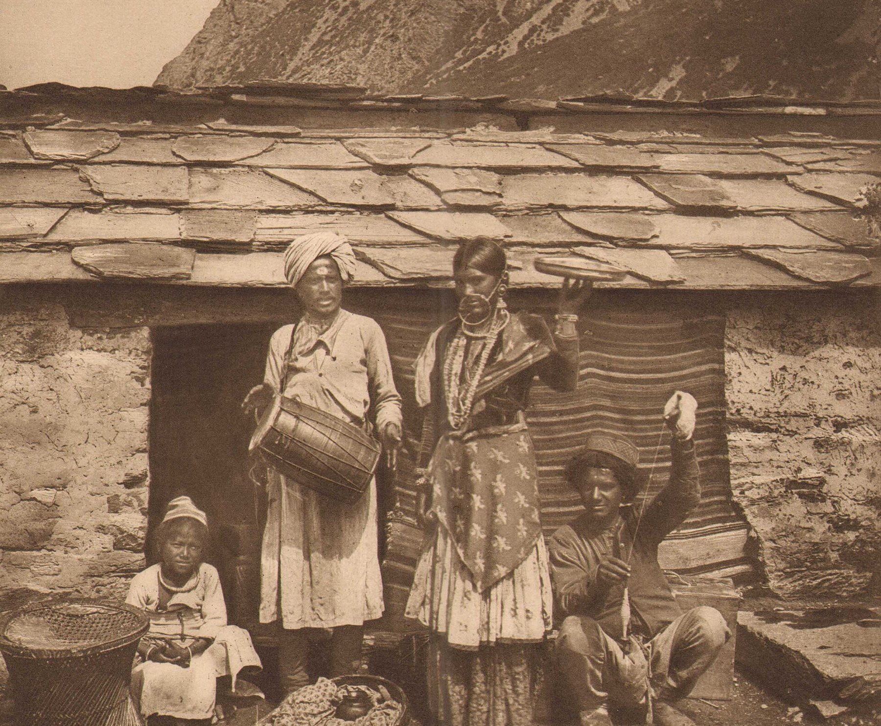 Johari traders outside a stone house at Milam in the 1890s · Photo: Kurt Boeck · Public domain, via Wikimedia Commons
1865–66: to Lhasa
The cousins left in early 1865. The direct way north from Kumaon was blocked, so they went round by Kathmandu and tried to cross into Tibet at Kyirong as horse dealers. They were turned back. On a second try Nain Singh got through with a caravan, but Mani Singh did not, and went off to western Tibet on his own.
Nain Singh joined the main trade road along the Tsangpo, the great river of southern Tibet, and followed it east, passing Shigatse, where he met the young Panchen Lama at Tashilhunpo monastery. In January 1866, a year after setting out, he walked into Lhasa. He rented two rooms in a caravanserai and stayed about three months. At night he took observations of the stars from his room to fix the city's latitude, and he boiled water to measure its height: 3,420 m, against a true value of about 3,540 m. He was even blessed by the young Dalai Lama at Sera monastery, and left in a hurry after he saw a Chinese visitor publicly beheaded.
He went back west with a Ladakhi caravan, about 500 miles along the trade road to Lake Manasarovar, and on to Gartok. From there he crossed the Himalaya "with difficulty" and reached Dehradun on 27 October 1866. He had paced some 1,200 miles and counted about 2.5 million steps. The Survey used his figures to draw the course of the Tsangpo across Tibet for the first time, and to put Lhasa on the map in very nearly the right place.
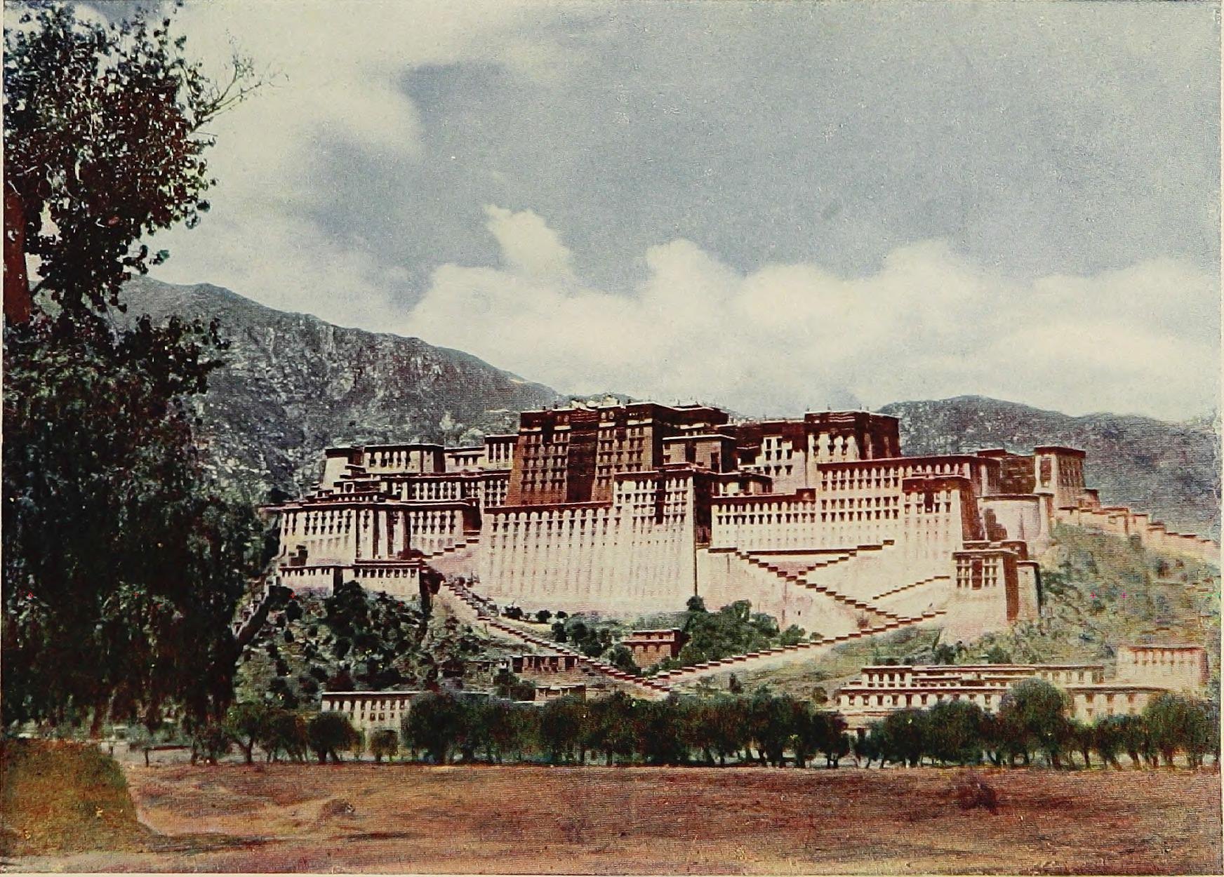 The Potala at Lhasa, photographed in 1904 · From L. A. Waddell, Lhasa and its Mysteries (1906) · No known copyright restrictions, via Wikimedia Commons
1867: the gold fields of Thok Jalung
In 1867 Nain Singh, Mani Singh and his brother Kalian Singh set out again, disguised as traders from Bashahr. They left Mussoorie in May and crossed the Mana Pass, above Badrinath, on 28 July. Mani Singh was held back as a hostage on the way, and Nain Singh went on to Thok Jalung, a gold field at nearly 5,000 m where the miners lived in pits dug into the ground to escape the wind. He later called it the coldest place he had ever been. Kalian Singh followed the Indus up towards its source. The party was back in British territory in November, with an 850-mile route survey.
1874–75: Leh to Lhasa and down to Assam
Nain Singh's last and longest journey began in Leh on 15 July 1874. He left with four companions and 26 sheep carrying the baggage, letting it be known that he was going north to Yarkand. Instead he took the Changchenmo road for two days, turned east, crossed into Tibet along Pangong Tso, and struck out across the Changthang, the high, empty plateau of northern Tibet, by a route no outsider had ever mapped. He passed gold diggings and a string of unmapped lakes, followed the northern shore of Tengri Nor (Nam Tso) for about 50 miles, and turned south to Lhasa, which he reached on 18 November.
This time he was recognised. He sent two men back to Leh with his notes, stayed only two days, and left heading north as a decoy before turning south after dark. He visited Samye, crossed the Tsangpo near Tsetang, went south over the Karkang pass and reached Tawang on 24 December. The authorities held him there for almost two months. On 1 March 1875 he reached Udalguri, in British Assam. He had covered 1,405 miles from Leh, and about 1,200 of them had never been mapped before.
He never went back to Tibet. Instead he trained younger explorers, among them Sarat Chandra Das. In 1877 the Royal Geographical Society awarded him its Patron's Medal "for his great journeys and surveys in Tibet and along the Upper Brahmaputra". The government gave him a village grant in Rohilkhand. He died, probably of cholera, at Moradabad on 1 February 1882.
Nain Singh's journeys on today's map
The colours on the map stand for Nain Singh's three journeys: red for 1865–66, amber for 1867 and blue for 1874–75. Dashed lines are historical routes: they show roughly where he went, not a track you can follow, and most of them are in Tibet. Solid lines are TrailX routes you can follow today. Tap a pin for what happened there.
| Journey | Then | On TrailX today |
|---|---|---|
| Home | Milam, in the Johar valley | The Upper Johar Expedition |
| 1865–66 | Kathmandu – Kyirong – along the Tsangpo – Shigatse – Lhasa; back west to Manasarovar and Gartok | Near his line in Tibet: Kailash Yatra Motorable portion |
| 1867 | Mussoorie – Badrinath – Mana Pass – Thok Jalung | Mana to Near Border - Mana Pass |
| 1874–75 | Leh – Changchenmo road – Pangong Tso – Changthang – Tengri Nor – Lhasa – Tsetang – Tawang – Udalguri | Leh - Chang chemno trail, Tangtse to Durbuk - Pangong Loop, Sela Pass, Road to Tawang |
| The Survey | Dehradun headquarters; sight lines to Peak XV | Dehradun to Dehradun - Himalayan Loop, Manebhanjan to Sandakphu Land Rover Road, Everest Basecamp trail |
Other pundits worth knowing
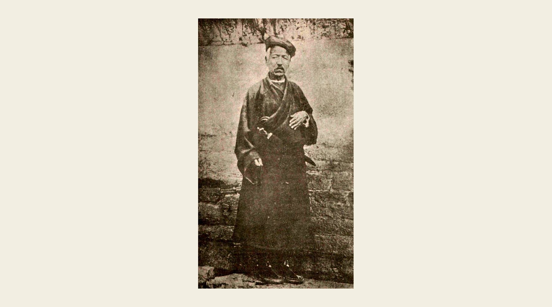 Kishen Singh, from The Modern Review, 1912 · Public domain, via Wikimedia Commons
Kishen Singh ("A-K") was Nain Singh's younger cousin, also from Milam. His great journey began in Darjeeling in April 1878. He spent a year in Lhasa disguised as a merchant, joined a caravan north across the Tibetan plateau towards Mongolia, lost almost everything to robbers, and came home by way of western China, reaching Darjeeling again on 12 November 1882. That one journey added about 2,800 miles to the map, and his lifetime total of about 4,750 miles was never matched. He came home to find that his only son had died. He was later given the title Rai Bahadur, and died in 1921.
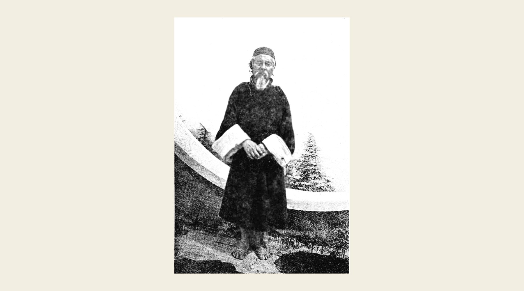 Kinthup in 1914 · Photo: Lt. G. Burrard · Public domain, via Wikimedia Commons
Kinthup was a Lepcha from Sikkim, sent in 1880 as the servant of a Chinese lama to find out whether the Tsangpo of Tibet was the same river as the Brahmaputra of Assam. The lama sold him as a slave and disappeared. Kinthup escaped, was caught, and was sold again, this time to a monastery. When the abbot gave him leave for pilgrimages, he used it to cut 500 logs, mark them, and throw them into the Tsangpo, as he had been told to, so that watchers downstream in Assam could catch them. But the officer who sent him had died, his letter from Lhasa went unread, and nobody was watching. Kinthup came home in November 1884, after four years, and was barely believed. In 1913 the explorers F. M. Bailey and Henry Morshead followed the Tsangpo gorges and found that his account was right.
There were others: Mani Singh and Kalian Singh from Milam; Hari Ram, who explored around Everest from the Nepal side; Ugyen Gyatso and Sarat Chandra Das, who went to Lhasa and Shigatse in the 1880s; and Abdul Hamid and Mirza Shuja, who went north to Yarkand and beyond. Several never came back.
Then and now
Every time you record a hike or plan a route, you are doing what the Survey did, with much better tools.
| Then | Now |
|---|---|
| 2,000 paces to the mile, counted on a rosary | GPS logs your position every second, to a few metres |
| Altitude from the boiling point of water: Lhasa came out 120 m low | Elevation from satellite terrain models and barometric sensors |
| Six sightings of Peak XV from 150 km away, averaged to 29,002 ft | GNSS receivers on the summit: 8,848.86 m in 2020 |
| Bearings and pace counts on paper hidden in a prayer wheel | A GPX track you can share with anyone |
| Months of hand calculation to draw one route | A route on a topographic map in seconds |
The tools changed. The idea didn't: to know a place, you measure it carefully and write it down so others can follow. If you want to try the modern version, see our guides to reading a topographic map, reading an elevation profile and creating a GPX route.
Following in their footsteps today
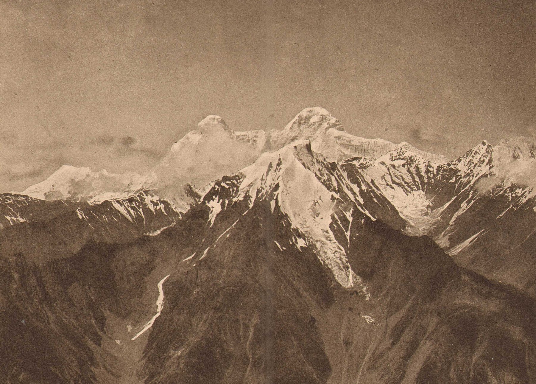 Nanda Devi from the ridge above Milam, in the 1890s · Photo: Kurt Boeck · Public domain, via Wikimedia Commons
- Milam and the Johar valley. Nain Singh's village is a few days' walk up the Gori Ganga from Munsiyari. Most of the houses are empty now: the old Tibet trade ended in 1962, and the families live in Munsiyari and lower down. The The Upper Johar Expedition covers 36.7 km of the valley from Milam. Milam is inside the Inner Line, so get an Inner Line Permit from the SDM office in Munsiyari before you go. In Munsiyari, the Pandit Nain Singh Surveyor Mountaineering Training Institute carries his name.
- The Mana Pass. The road beyond Mana, the last village above Badrinath, climbs to the pass Nain Singh crossed in 1867. The Mana to Near Border - Mana Pass covers 18.9 km of it. Access needs a permit through the administration at Joshimath, and the road is open only in summer.
- Leh and Pangong. The Leh - Chang chemno trail drives 198.6 km from Leh towards the Chang Chenmo valley, the way Nain Singh slipped out of Ladakh in 1874, and the Tangtse to Durbuk - Pangong Loop loops along Pangong Tso. Both are in protected areas: Indian citizens register on the LAHDC permit portal, and foreign nationals need a Protected Area Permit through an agency in Leh.
- Tawang. The Road to Tawang drives 523.7 km from Guwahati over the Sela Pass to Tawang, the reverse of Nain Singh's last miles in 1875. You need an Inner Line Permit (Indian citizens) or a Protected Area Permit (foreign nationals) for Arunachal Pradesh.
- Dehradun and Mussoorie. The Survey of India is still headquartered in Dehradun. Above Mussoorie, George Everest's house at Park Estate, built in 1832, was restored and opened to visitors in December 2021, with a small museum of surveying. The Dehradun to Dehradun - Himalayan Loop starts from Dehradun.
- Lhasa and western Tibet. Most of Nain Singh's routes are in the Tibet Autonomous Region of China. Foreign visitors need a Tibet Travel Permit and an organised tour. Indian pilgrims can reach Lake Manasarovar on the Kailash Mansarovar Yatra over the Lipulekh pass; see our guide to the mountain passes of India.
Their legacy
Radhanath Sikdar's work disappeared into the Survey's tables, and the only time most people hear his name is in a story he may never have lived. Nain Singh's name was kept secret for years, and he died in a small town in the plains, half forgotten. In June 2004 India Post put both men on stamps for the Survey's bicentenary. A range of mountains south of Pangong Tso is named the Nain Singh Range, and on 21 October 2017, his 187th birthday, Google put him on its home page.
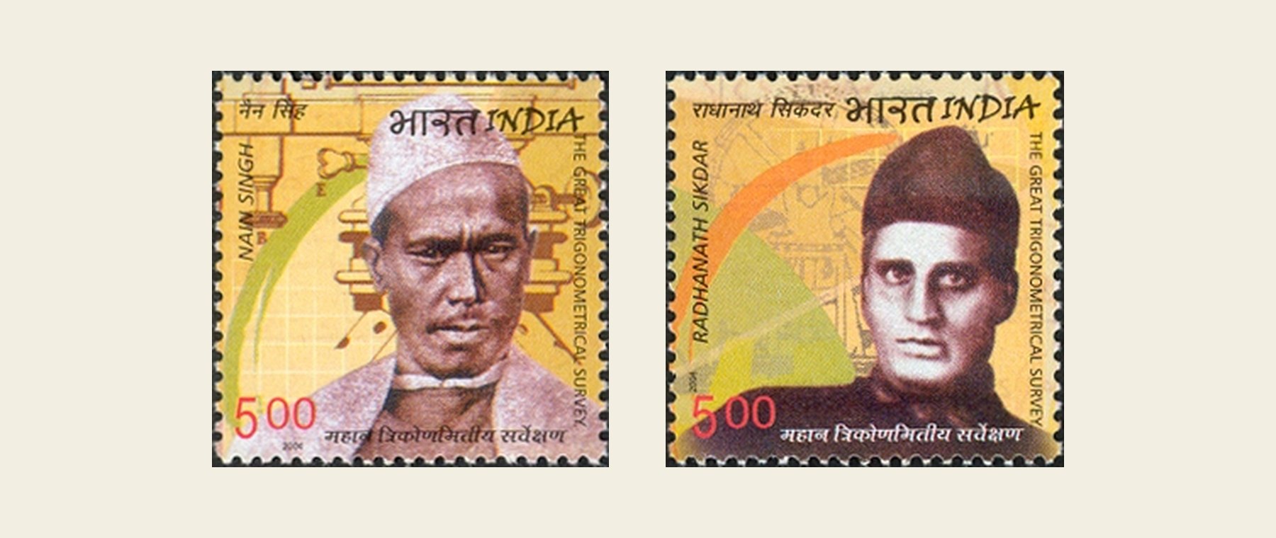 India Post stamps of 2004 honouring Nain Singh and Radhanath Sikdar · Government of India · GODL-India, via Wikimedia Commons
Their real legacy is the map itself. The lines of the Survey's triangles still lie under the Survey of India's topographic sheets, and the course of the Tsangpo, the position of Lhasa and the height of Everest were all first worked out by people who measured them with their own hands, eyes and feet. Next time your GPS draws a neat line across a high pass, think of a man in a borrowed robe, turning a prayer wheel and counting under his breath.
For more history on the map, follow General Zorawar Singh's routes through Ladakh or the ancient trade routes of silk, salt and spice.

Written by
TrailX
Hikers, riders and drivers mapping the world's trails, and sharing what we learn along the way.
Responses